Maragang Hill, Sabah: A Hiker's Guide (2026)
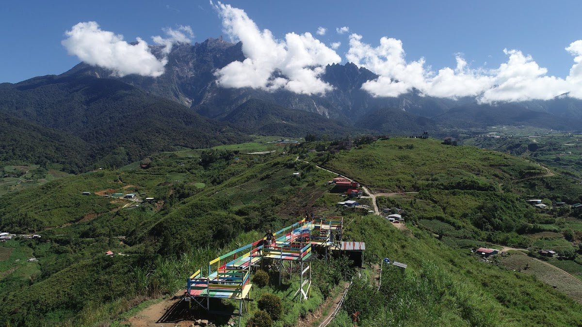
Maragang Hill sits on the east ridge of Mount Kinabalu at 2,232 metres above sea level, and its whole selling point is right there in plain sight — on a clear morning, you get a face-on granite ridge view of Kinabalu that most people only see from the highway. This is the hike that gives you the real look at Sabah's crown without the permit lottery, the altitude acclimatisation headaches, or the four-figure climbing fees.

Maragang is genuinely accessible — moderate difficulty, 1.5 to 2 hours to the summit at a decent pace — but don't let that fool you into packing light or starting late. The terrain is mossy, muddy, and steep in stretches, and the cloud rolls in fast after 9 AM. Timing and preparation matter here as much as on any bigger mountain. It's popular with Kinabalu climbers using it as a training hill, and it works well as a standalone experience for families and first-timers too. Age requirement is 5 to 65 years old, so yes, the kids can come — but parents must accompany children under 12.
The hike is managed by the Mesilou Ecotourism Association (META), which means a mandatory guide, a conservation fee, and a community-backed system that keeps the trail in reasonable shape. That's a good thing. Maragang is a well-organised operation by Malaysian hiking standards.
Quick Facts
- Summit elevation: 2,232 m
- Elevation gain: approximately 340–397 m (sources vary; starting elevation around 1,835 m)
- Distance: approximately 2.9 km one-way; ~4 km round trip (sources disagree slightly — expect somewhere in this range)
- Time to summit: 1.5–2 hours at normal pace; 3–4 hours total including descent and breaks
- Difficulty: Moderate — steep 35-degree slopes, consistently slippery terrain
- Guide required: Yes, mandatory through META
- Permit/registration: Yes, mandatory at META office
- Age limit: 5–65 years old
- Best season: March to September (dry season)
Getting There & Parking
Maragang Hill is located in Kampung Mesilau, Ranau, roughly 2 hours' drive from Kota Kinabalu town. If you're driving, head to the Mesilou Ecotourism Association (META) office — that's your start point and where you park. The parking lot is right at the META office.
No personal vehicle? Take a mini bus or taxi from Jalan Padang Bus Station in Kota Kinabalu towards Kundasang, then charter a vehicle from Kundasang to the META office. It's a common enough route — the drivers in Kundasang know where Mesilau is. Just confirm the chartered ride back as well, because you don't want to be stranded post-hike at altitude.
Permits & Fees
Registration with META is mandatory, full stop. No walk-ins on a whim — book at least one week in advance, especially if you're going on weekends or during school holidays when visitor numbers are capped.
Based on the most recent figures available, expect to pay roughly RM160–200 for guide and transport plus a RM30 conservation fee per person (2026 update). For reference, older 2022 rates listed the conservation fee separately as RM10 for Malaysians and RM15 for non-Malaysian adults, with guide fees of RM70 for day trips and RM100 for sunrise or loop options — the all-in package pricing above is the more current figure to work from.
Two hike options are available: the regular day trip (6 AM start) and the sunrise hike (3 AM briefing, 4:30 AM departure). The sunrise option costs more but you get Kinabalu lit up in dawn light before the fog takes over. Worth it if clear skies are your priority.
Payment is made in cash at the registration office on the day. Bring enough ringgit — there's no ATM up there.
Trail conditions and permit requirements change — always check with the local forestry office or park authority before you go. Or ask the TAHAN Hiking Community on WhatsApp — someone's usually been there that week. Checking a different gunung? Try our free permit checker — instant answer for 90+ Malaysian mountains.
The Trail: What to Expect
The route is straightforward — one main trail to the summit, with distance markers along the way. Sections of wooden boardwalk have been laid to protect the sensitive cloud forest ecosystem. Outside those sections, you are walking on mossy, root-tangled, frequently wet ground. Treat every step like it might slip, because on Maragang, a lot of them will.

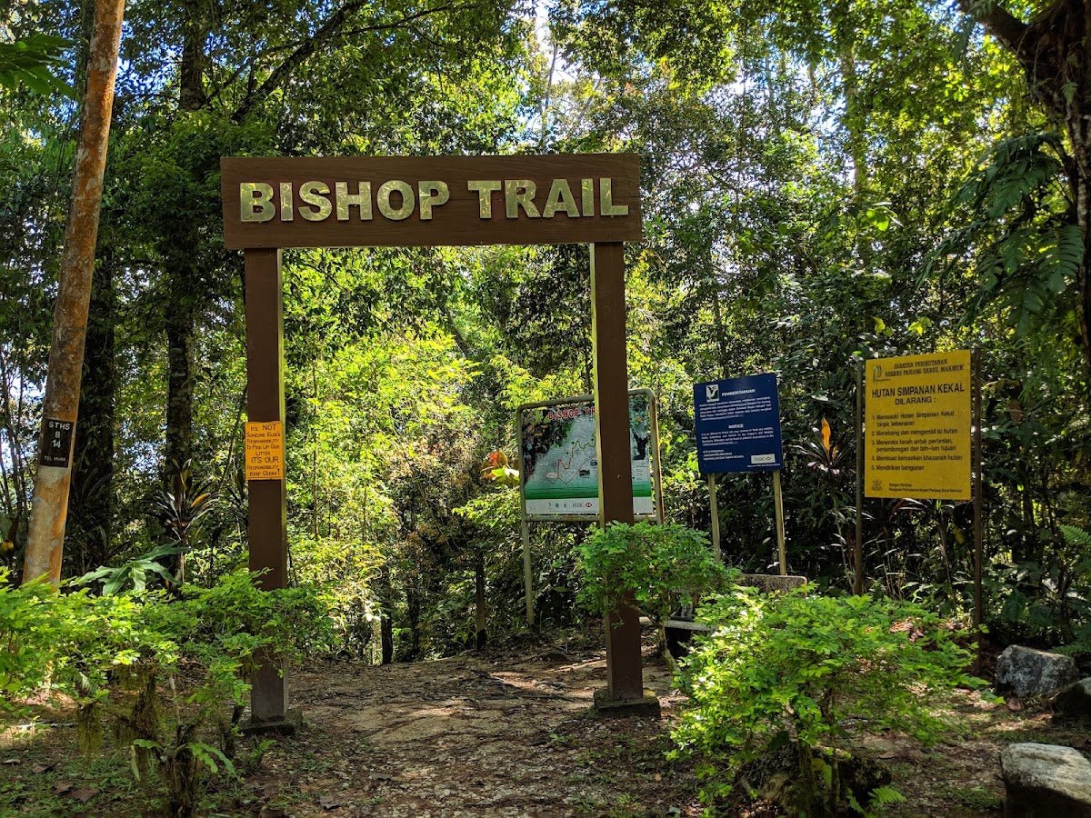
META Registration Office — Trail Start
After registration and briefing, your assigned META guide leads off from the office. Starting elevation here is around 1,835 m — you're already high up, and the air has that cool, thin quality that makes early morning starts feel good. The first stretch eases you in, but the slope picks up quickly.
200 m Marker
Early distance check. The trail is already getting into thick vegetation. Mossy rocks and roots start appearing underfoot. Nothing technical yet, but this is where you learn whether your footwear has enough grip. If your boots are sliding here, mentally prepare — it gets steeper.

500 m Marker — Resting Gazebo
There's a resting gazebo here and a squat toilet. Take the break if your group needs it, especially if you have kids or slower hikers. Hydrate here — there are no confirmed water points along the trail, so whatever you're carrying is what you have. Past this point, the trail starts hitting those 35-degree slopes in earnest.
1 km Marker
You're in the heart of the mossy cloud forest now. The canopy is dense, the ground is consistently damp, and the atmosphere is properly magical — pitcher plants, moss-covered trees, the works. It also means traction is a constant challenge. Slow and steady on the steep sections. Your guide will set the pace.

1.3 km Marker
You're getting close. The trail continues its climb. Vegetation may start to thin slightly as you approach the upper ridge. On a sunrise hike, this is where the sky starts doing interesting things if the weather is cooperating. On a day hike, this is around where you start feeling the burn in your legs from sustained steep gradient.
Summit — 2,232 m Wooden Platform
The summit has a wooden platform, and on a clear morning the view is genuinely jaw-dropping — Kinabalu's full granite ridge, unobstructed, right in front of you. On a good day you also get 360-degree views over the Crocker Range. Drone photography is permitted at the peak as it sits outside Kinabalu Park's boundary.
Get here before 8:30 AM if you want clear views. Dense fog typically rolls in after 9 AM and that's not an exaggeration — one hiker described arriving early enough to see the moon and stars still out before the clouds took over. By mid-morning, Maragang summit is often sitting in a grey cloud. Time your push accordingly.

Descent & Safety
The descent is where most slips and tumbles happen on Maragang. The same mossy, steep terrain that challenged you on the way up is now even more dangerous when your legs are tired and you're rushing to beat the fog or make a bus. Don't rush it.
If you're taking the loop trail option (approximately 3 miles total, around 3 hours), be aware that the descent section involves rope handling on slippery terrain. Gloves are not optional on the loop — they're protection for your palms when you're gripping the rope on a muddy slope.
Key hazards to keep in mind throughout:
- Mossy and slippery terrain throughout the entire trail — no flat, easy sections
- Muddy slopes intensify significantly after rain or during the wet season (October to February)
- 35-degree steep hills on multiple sections
- Uneven ground in several areas — ankle-rolling terrain
- Rope sections on loop trail descent require grip strength and stable footing
- Dense fog after 9 AM reduces visibility and makes an already slippery trail harder to navigate
- Unexpected rain can arrive fast — weather in the montane zone is not predictable
Turn back or hold at the gazebo if rain is heavy and sustained. Wet 35-degree moss slopes are not the place to push on out of stubbornness. Your guide will advise — listen to them.

What to Bring
Maragang's combination of elevation, moisture, and steep terrain means your gear choices matter. Here's what I'd pack for this specific hike:
- Hiking boots with solid grip — not trail runners, not sneakers. Waterproof if you have them, because the forest floor is perpetually damp and post-rain mud is real
- Trekking poles — genuinely useful on steep, slippery descents. The TAHAN 3-Section Foldable Hiking Stick V2 (RM99) is compact enough to stow when you don't need it and solid when you do — good value for a hike like this
- Knee support — if your knees feel anything on steep descents, sort this out before you go. The TAHAN Kinetix Knee Guard with Spring Support (RM79) takes a lot of the load off the downhill grind
- Gloves — essential for the loop trail rope sections, and useful grip on steep sections generally
- Sufficient water — no confirmed water points on trail; carry at minimum 1.5–2 litres per person
- Rain jacket or poncho — the weather can change without warning at 2,000+ metres
- Headlamp with fresh batteries — mandatory for the 3 AM sunrise hike, and a good backup to have on any hike starting before dawn
- Warm layer — at 2,232 m before sunrise, it gets cold. A fleece or light down jacket takes no space and you'll thank yourself for it on the summit platform
- Snacks and enough food for the duration — 3 to 4 hours total with breaks
- Cash — for fees at META office, no card machines up there
Not sure what to prioritise for gear? Check out our hiking gear guide — it covers poles and knee support in more detail for Malaysian trail conditions.
FAQ
How hard is Maragang Hill?
Moderate — but don't underestimate it. The trail is rated moderately easy, but it's steep (35-degree slopes) and slippery throughout. The elevation gain is around 340–397 m over a short distance, which means it's consistently uphill with no real flat stretches. First-timers and families with kids can do it, but go at a sensible pace and expect your legs to know about it the next day.
How long does Maragang Hill take?
Most hikers reach the summit in 1.5 to 2 hours. Total time including descent and breaks is 3 to 4 hours for the regular out-and-back. The extended loop trail option takes around 3 hours of moving time, so total with breaks is longer. Build in buffer time — this isn't a hike to rush.
Do I need a permit or guide for Maragang Hill?
Yes to both, and they're the same system. You register through the Mesilou Ecotourism Association (META), which assigns you a mandatory guide. You cannot hike Maragang independently — the guide requirement is enforced, not optional. Book at least a week ahead, more for weekends and school holidays.
What time should I start the hike?
For the regular day hike, start at 6 AM. For sunrise, the briefing is at 3 AM with a 4:30 AM departure. Either way, you need to be at the summit before 8:30 AM — dense fog typically covers the area after 9 AM and the Kinabalu views disappear. Starting late means you're likely hiking in fog and missing the whole point.
Camp Nearby?
Making a weekend of it? Maragang is a day hike, but the Sabah interior has some solid places to base yourself or extend the trip. For rainforest immersion, the Tungog Rainforest Eco Camp, Sabah is worth a look — proper jungle experience in the region. If you're willing to travel a bit further around the north coast, check out Dingin Batu Campsite, Kota Belud and Nulinau Glamping Garden, Kota Belud for options in that direction. Staying somewhere the night before also means you're rested and ready for a 3 AM sunrise start — and trust me, the sunrise on Maragang is worth waking up for.
Trail conditions, permit updates, and hiking buddies for the weekend — all in one WhatsApp group. Just ask; someone was probably up there last week.
💬 Join the Hiking CommunityFree, one click. No spam — the occasional promo at most.
Gear tip: How to use a trekking pole (and set the height).
Mike has been camping across Malaysia for over 10 years — from jungle treks in Taman Negara to beach camps in Perhentian. He writes about it so you don't have to find out the hard way. Follow along on TAHAN Outdoor's blog for honest campsite reviews, every week.
⛺ Featured in: The 5 Best Hikes in Sabah (2026)