Bukit Fraser Pine Tree Trail: A Hiker's Guide (2026)
Bukit Fraser — or Fraser's Hill as most Malaysians call it — is famous for cool air, colonial bungalows, and weekend getaways. What most visitors don't realise is that tucked behind all of that is one of the most demanding trails in Pahang. The Pine Tree Trail to Twin Peak is not a leisure stroll. It's a technical jungle hike with steep scrambles, ropes, leeches, and enough fallen bamboo to make you question your life choices. Experienced hikers love it for exactly those reasons.

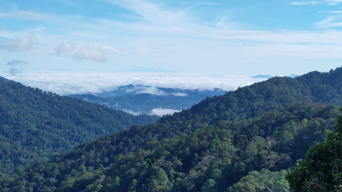
This trail is a popular training route for climbers preparing for Gunung Kinabalu — that tells you everything you need to know about difficulty level. If you're new to hiking, this is not where you start. But if you've got a handful of serious hikes under your belt and want a proper challenge in a highland rainforest with moss-covered trees, wild orchids, and Titiwangsa Range views on a clear day, Pine Tree Trail delivers.
At 13.5 km round trip with roughly 1,500 m of actual climbing (due to the constant ups and downs of the ridge), this hike demands your full attention and an early start. Here's what you need to know before you go.
Quick Facts
- Summit elevation: Pine Tree Peak — 1,448 m; Twin Peak — 1,505 m
- Starting elevation: 1,329 m (Pine Tree trailhead)
- Distance: 13.5 km round trip (Pine Tree Trail to Twin Peak)
- Elevation gain: ~127 m net, but approximately 1,500 m actual climbing due to the undulating ridge
- Duration: 6–8 hours total; fit hikers report 3 hours up, 2.5 hours down — budget 7–8 hours to be safe
- Difficulty: Very challenging / Advanced — not suitable for new hikers
- Permit required: Yes (Pahang Forestry Department)
- Guide required: Yes, a jungle guide is mandatory for Pine Tree Trail
- Trailhead GPS: 3.712077N, 101.728494E
Getting There & Parking
The trailhead is at the end of High Pines Road, Fraser's Hill, beside TM Resorts. GPS coordinates: 3.712077N, 101.728494E. From Kuala Lumpur, it's roughly 2 to 2.5 hours north towards Kuala Kubu Bharu, then up through 'The Gap' road into Fraser's Hill. The mountain road is fully paved — no 4WD needed to get here.
Parking is the trickier part. There's no dedicated car park at the Pine Tree Trail arch, and space near the bungalow houses along High Pines Road is limited. If you can't find a spot right at the trailhead, free parking is available in the main Fraser's Hill areas — the town square, near the clock tower, and around the golf course. Factor in extra walking time from wherever you park, and don't leave valuables visible in your car.

Permits & Fees
The Pine Tree Trail runs through a permanent forest reserve, so a permit from the Pahang Forestry Department is required. Apply at least 7 days in advance — payment is by bank draft or postal order. The exact fee amount wasn't confirmed in any source we checked, so don't assume it's free. Contact the Pahang Forestry Department directly to confirm the current fee before applying.
Beyond the permit, a registered jungle guide is compulsory for this trail. This isn't just bureaucracy — the trail is genuinely technical and not well-signed in sections. Factor the guide fee into your budget and arrange this before your trip date, not on the morning you plan to hike.
Trail conditions and permit requirements change — always check with the local forestry office or park authority before you go. Or ask the TAHAN Hiking Community on WhatsApp — someone's usually been there that week. Checking a different gunung? Try our free permit checker — instant answer for 90+ Malaysian mountains.
The Trail: What to Expect
The Pine Tree Trail is a point-to-point ridge hike with a lot of character — and a lot of accumulated elevation. The net gain from trailhead to Twin Peak sounds modest on paper, but the actual ~1,500 m of climbing across 13.5 km tells the real story. You go up, come down, go up again. Repeat. On terrain that is often muddy, rooted, and narrow.

Pine Tree Trailhead (1,329 m)
The hike starts at the Pine Tree Trail arch at the end of High Pines Road. From the outset you're in proper highland rainforest — moss on everything, cool air, the smell of damp earth. Don't be lulled by the early flat sections. The trail quickly starts doing what it does: undulating ridge terrain with occasional concrete and wooden stairs that have uneven footing. Watch your step from the start. Leeches are active immediately — do a sock check early and often.
Gua Akar
An early landmark and useful reference point to confirm you're on the right line. The trail around here weaves through sections of fallen bamboo and branches — some maintenance has been inconsistent, and you may need to duck, step over, or push through. This is not a manicured trail. Expect to work for it.
Kemsite Pine Tree
A rest point along the ridge. Good spot to regroup, check for leeches, and assess how your group is feeling. If anyone in your group is already struggling significantly here, have a realistic conversation about turning back — there's harder terrain ahead.
Water Source (~1.5 hours in)
There's a water source approximately 1.5 hours into the hike. This is the main reliable water point on the trail, so top up here if you're carrying a filter or purification. Don't rely on finding water beyond this point — bring sufficient drinking water from the start regardless.
Pine Tree Peak (1,448 m)
This is where the trail earns its reputation. Getting to Pine Tree Peak involves a 60-degree near-vertical scramble using fixed ropes. This section is genuinely exposed and seriously slippery when wet. Take your time, use the ropes properly, and do not rush anyone. At the top you'll find a rare corybas orchid farm — a genuinely unusual highland ecosystem that most Malaysian hikers have never seen. On a clear day, views of the Titiwangsa Range open up from here.

Twin Peak (1,505 m)
The true high point of the hike at 1,505 m. From Twin Peak on a clear morning you get sweeping views of Fraser's Hill below, the telecom towers of Bukit Peninjau, and the broader Titiwangsa Range stretching out. The forest along this section rewards patience — migratory birds including Siberian thrush have been recorded here, rare trig oak trees line the ridge, and wild ginger flowers appear in clearings. This is a proper highland rainforest, and it shows.

Descent & Safety
Coming down Pine Tree Trail is its own challenge. The 60-degree rope section at Pine Tree Peak is more intimidating on descent — faces outward, footing is harder to read, mud makes everything slippery. Lower yourself carefully and don't let the relief of having summited make you careless on the way down.
The entire trail is faster on the way back but not necessarily easier. Tired legs on uneven, muddy terrain with fallen bamboo is a recipe for a turned ankle. Most hikers report 2.5 hours down for the fit end of the group — budget more time if anyone is fatigued.
Known hazards on this trail:
- Fallen bamboo and muddy sections throughout
- Very steep and slippery terrain, especially in rain
- 60-degree vertical scramble using ropes at Pine Tree Peak
- Heavy leech presence — use leech socks, not just regular hiking socks
- Fallen branches and trees across the path
- Concrete and wooden stairs with uneven, sometimes broken footing
- Unpredictable weather with frequent rain and mist
- Exposed scrambling sections on the ridge
Fraser's Hill weather is genuinely unpredictable. Mist rolls in fast and rain can turn the scramble sections dangerous quickly. If you reach the trailhead and conditions are already bad, or if weather closes in on the ridge, turn back. The mountain will be there next time. Start as early as you can — aim to be on trail by 7 am to give yourself maximum daylight and the best chance of clear morning views before the afternoon clouds build.

What to Bring
This is a demanding 6–8 hour hike in a highland rainforest. Pack accordingly:
- Water: Minimum 2–3 litres. There's one water source at ~1.5 hours in but don't rely on it as your only supply. A hydration bladder makes drinking on the move much easier — the TAHAN TrailBladder 2L is a solid, affordable option that keeps your hands free on the scramble sections.
- Trekking poles: Not optional on this trail — they're essential for the descents and muddy sections. The TAHAN 3-Section Foldable Hiking Stick V2 packs small enough to stow during the rope scramble and deploys immediately after. Worth every ringgit on the way down.
- Leech socks: Non-negotiable. Wear them over your hiking socks from the start.
- Knee support: Seriously consider it for the long descent. Your knees will feel every one of those 1,500 m of accumulated climbing on the way back down.
- Waterproof jacket or poncho: Weather changes fast at this elevation. Always have one accessible, not buried in your bag.
- Food and snacks: High-energy snacks for sustained energy — energy bars, nuts, bananas. A proper meal for a mid-hike rest.
- Headlamp: If your timing slips, you don't want to be descending in darkness without one.
- First aid kit: Blister treatment, antiseptic for leech bites, paracetamol.
- Trail shoes or boots: Proper grip soles. Not running shoes. Not sandals.
- Dry bag or rain cover for pack: Protect your phone, ID, and car keys.
For more on choosing the right gear for Malaysian highland hikes, check out our hiking gear guide — covers poles, knee guards, and what's actually worth carrying up a mountain.
FAQ
How hard is the Pine Tree Trail at Fraser's Hill?
Very hard. This is the toughest trail in Bukit Fraser and is used as a training route by hikers preparing for Gunung Kinabalu. The combination of 1,500 m of actual climbing over 13.5 km, a 60-degree rope scramble, persistent mud, and heavy leech presence makes it advanced-level hiking. If you haven't completed multiple serious mountain hikes before, don't start here.
How long does the Pine Tree Trail to Twin Peak take?
Most fit hikers report around 3 hours up and 2.5 hours down. But budget 7–8 hours for the full round trip — that accounts for rest stops, the scramble sections, and the realistic pace of a group rather than a solo speedster. Add time if anyone in your group is a slower hiker or if conditions are wet.
Do I need a permit for the Pine Tree Trail?
Yes. A permit from the Pahang Forestry Department is required, as the trail runs through a permanent forest reserve. Apply at least 7 days in advance by bank draft or postal order. A registered jungle guide is also compulsory — this is a legal requirement, not a suggestion. Contact the Pahang Forestry Department directly for the current fee and application process before making plans.
Are there leeches on the Pine Tree Trail?
Yes, and a lot of them. Leeches are present throughout the trail — bring proper leech socks and do regular checks during rest stops, especially on your ankles and behind your knees. Leech bites are not dangerous but they're annoying and bleed more than expected. Tobacco, salt, or insect repellent on the socks helps reduce the frequency of encounters.
Camp Nearby?
Making a weekend of it? Fraser's Hill itself is a bit of a drive from Kuala Lumpur, and getting an early start on the trail is genuinely important for this hike — staying nearby the night before makes a lot of sense. The Bentong and Janda Baik corridor on the way up is great for camping options. Check out Woodstock Camp Janda Baik and Glamping Valley @ Janda Baik for two very different vibes in the same area, or Camp Mantap, Bentong if you want something closer to the Bentong side. Any of these let you rest up properly before the hike and drive the remaining distance fresh in the morning.
Trail conditions, permit updates, and hiking buddies for the weekend — all in one WhatsApp group. Just ask; someone was probably up there last week.
💬 Join the Hiking CommunityFree, one click. No spam — the occasional promo at most.
Gear tip: Water bladder or bottle on a humid trail.
Mike has been camping across Malaysia for over 10 years — from jungle treks in Taman Negara to beach camps in Perhentian. He writes about it so you don't have to find out the hard way. Follow along on TAHAN Outdoor's blog for honest campsite reviews, every week.