Gunung Serapi: A Hiker's Guide (2026)
Gunung Serapi sits inside Kubah National Park, about 30–40 minutes from Kuching city, and it punches well above its 911 m elevation. The whole trail is paved — tarmac from bottom to top — which sounds easy until you're halfway up and your quads are screaming. This is a relentless, no-shade cardio grind on the way up, rewarded by a viewing platform with one of the most satisfying panoramas in Sarawak: Kuching city, Mount Santubong, the southwest coastline, and on a clear day, peaks across the Indonesian border.

Gunung Serapi suits fit beginners who respect what "steep" actually means, regular hikers looking for a solid half-day workout, and birders or nature lovers who want Bornean biodiversity without multi-day jungle logistics. The park is well-managed, facilities are decent, and the trail is clear. What it is not: easy. One reviewer described it as "a brutal but highly rewarding climb" and that's accurate. Come prepared.
There are multiple trail options inside Kubah — six in total — ranging from 45 minutes to a full day out. This guide focuses on the Main Summit Trail and touches on the longer Rayu Trail, because those are what most people come for. If you also want the waterfall, the Blue Waterfall Trail branches off and is worth the detour.
Quick Facts
- Elevation: 911 m
- Elevation Gain: 712 m (2,335 ft) Main Summit Trail; 878 m (2,883 ft) Rayu Trail
- Distance: 5 km one-way / approximately 10.9 km round trip (Main Trail); 9.9 mi round trip via Rayu Trail
- Duration: 3.5 hours one-way (Main Trail); 4.5–5 hours round trip (Main Trail); 6–6.5 hours (Rayu Trail)
- Difficulty: Moderately challenging to hard
- Trailhead: Kubah National Park HQ, Lundu District, Kuching Division, Sarawak
- Park Hours: 8am–5pm; last entry 2pm; must return by 4:15pm
- Permit / Entry Fee: Yes — see Permits section
- Guide Required: No (standard hiking)
- Parking: Yes, at National Park ticket booth
- Toilets: At parking lot and HQ area
Getting There & Parking
Kubah National Park is in Lundu District, roughly 30–40 minutes by car from Kuching city centre. There's no public bus route that drops you at the park gate, so you're looking at a hire car or Grab. Grab works fine from Kuching — just make sure you arrange a return ride or have the driver wait, because signal inside the park is patchy and flagging a Grab from the trailhead is not reliable.
Parking is available at the National Park ticket booth. It's a proper parking lot, nothing sketchy. Toilets are at the parking area and again at HQ, so sort yourself out before you start the climb — there are no facilities on the trail itself.
Permits & Fees
Kubah National Park charges an entry fee at the ticket booth. Current rates (2025/2026):
- Malaysian adults: RM10
- Malaysian children (age 7+): RM3
- Foreign adults: RM20
- Foreign children (age 7+): RM7
- Children under 6: Free
You must sign in when you enter and sign out when you leave — this is a safety register, not just bureaucracy. Don't skip it. Last entry is 2pm and you must be back by 4:15pm, so plan your start time accordingly. If you want to do evening Frog Pond herping, that's a separate arrangement with park staff. Professional photography requires an advance permit from the National Park Booking Office.
Trail conditions and permit requirements change — always check with the local forestry office or park authority before you go. Or ask the TAHAN Hiking Community on WhatsApp — someone's usually been there that week. Checking a different gunung? Try our free permit checker — instant answer for 90+ Malaysian mountains.
The Trail: What to Expect
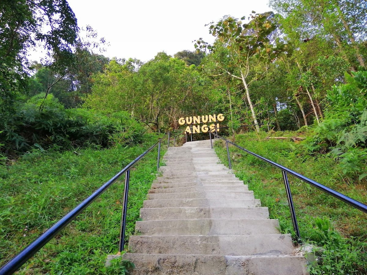
The Main Summit Trail is paved tarmac the entire way. That sounds like a positive until you realise it means zero soft landing for your joints and zero excuse to slow down for rough terrain — the mountain just goes up, and up, and up. The Rayu Trail adds distance and elevation but takes you through richer forest. Both are well-marked.

Trailhead at Park HQ (0 m)
Sign in at the register, grab your bearings at the trail map, and start moving. The tarmac road begins immediately. Within the first stretch you're already climbing. The canopy is tall and the bird noise is constant — red-bearded bee-eaters, blue pitta, kingfishers, broadbills — Kubah's birdlife is genuinely world-class if you're paying attention. There's a drinks vending machine at HQ; this is your last guaranteed refill point, so top up your water here.
Frog Pond Checkpoint (285 m elevation)
The Frog Pond is Kubah's famous nocturnal attraction — over 60 frog species, including rare nocturnal varieties. During the day it's a pleasant rest point. Note: evening access to the Frog Pond requires a park staff member to accompany you, so if that's on your agenda, arrange it in advance at HQ. On the Main Summit Trail you pass through this area and keep climbing.

Trail Junction — Rayu / Waterfall Trails (approx. 300 m from start)
Here the Rayu Trail (orange/red markers) and the Blue Waterfall Trail branch off. If you're doing the Main Summit Trail, stay on course. If you want to extend your day with the Rayu Trail, it passes through scenic riverine forest with proper Bornean rainforest giants — buttress roots, bintangor trees, the works — and adds significant distance and elevation gain (878 m total vs 712 m on Main). The waterfall trail leads to Kubah Falls through dipterocarp forest with wooden boardwalks over streams; worth it if you have time and energy.
Mid-Trail Pondoks and Climbing to ~800 m
Multiple resting shelters (pondok) are spaced along the route. Use them. The gradient doesn't really relent — one hiker put it plainly: "incline upon incline." The surrounding forest is extraordinary compensation: over 93 palm species, rare ferns, orchids, abundant butterflies, and if you're lucky, bearded pigs, mouse deer, or giant squirrels crossing the road ahead of you. The sounds of cascading water and birds fill the whole climb.

Viewing Platform Near Summit
At the top, you reach the viewing platform — and this is where you stop. The true peak of Gunung Serapi has a military telecommunications tower and access is restricted. Hikers are turned back approximately 100 m below the true summit. Don't try to push past the restricted zone; this is enforced. The viewing platform itself, though, is the payoff: panoramic views of Kuching city, Mount Santubong, the southwest Sarawak coastline, and Indonesian border peaks on a clear day. Sunrise and sunset from here are particularly good.

Descent & Safety
Coming down tarmac is harder on your body than going up. Your knees take the full brunt, and the surface becomes dangerously slippery when wet. This is not a minor caveat — people slip badly on wet concrete slopes. If it has rained or starts raining during your descent, slow right down and take it seriously.
Key hazards on Gunung Serapi:
- Restricted summit access: Military/telecommunications tower at the true peak — hikers are turned back about 100 m below. Respect this boundary.
- Slippery tarmac when wet: Particularly hazardous on descent. Not negotiable — slow down.
- Unpredictable tropical weather: Bring a change of clothes. Afternoon storms are common.
- Footwear rules: Closed hiking shoes are mandatory. Sarawak Forestry enforces this — no slippers, sandals, or open-toed shoes. You will be turned away at the gate.
- Time cutoff: Last entry is 2pm, must return by 4:15pm. Start early. Don't be the person who races down in failing light.
If weather turns bad — heavy rain, thunder, reduced visibility — turn back. The views will still be there next weekend. The tarmac in the wet is genuinely treacherous on the descent, and there's no shelter on the upper sections of the trail.

What to Bring
Gunung Serapi is a half-day hike on a paved trail, but it's steep, tropical, and your knees will know about it the next day. Pack accordingly.
- Water: Bring sufficient bottled water. There are occasional roadside water sources but don't rely on them. There is no filter-worthy stream access on the main trail.
- Closed hiking shoes: Non-negotiable. Park will turn you away in sandals.
- Rain jacket or poncho: Tropical weather changes fast.
- Change of clothes: You will sweat through whatever you wear.
- Snacks / energy food: No food stalls on trail.
- Sunscreen and insect repellent.
- Small first aid kit.
On the descent specifically — the tarmac is relentless on your knees. If you have any history of knee issues, or if you're newer to steep hiking, a trekking pole makes a real difference. The TAHAN 3-Section Foldable Hiking Stick V2 (RM99) packs down small enough to carry in a daypack and earns its keep on the way back down. Pair it with the TAHAN Kinetix Knee Guard With Spring Support (RM79) if your knees are already giving you grief on regular hikes — multiple reviewers mention sore legs lasting into the following week on this one. For more on choosing the right support gear for Malaysian trails, check out our hiking gear guide.
FAQ
How hard is Gunung Serapi?
Moderately challenging to hard, depending on your fitness level. The trail is fully paved tarmac with no technical scrambling, but the gradient is relentless from bottom to top — it's essentially a steep road with almost no flat sections. Fit beginners can do it, but go in knowing it's a real workout, not a casual stroll. The descent on wet tarmac adds a genuine hazard element.
How long does it take to hike Gunung Serapi?
On the Main Summit Trail, most hikers report around 3.5 hours one-way, or 4.5–5 hours for the full round trip. The longer Rayu Trail takes 6–6.5 hours round trip. Factor in rest breaks at the pondoks. Given the last entry is 2pm and you must return by 4:15pm, aim to start as early as possible — 8am when the park opens is ideal.
Do I need a permit or guide for Gunung Serapi?
You need to pay the Kubah National Park entry fee (RM10 for Malaysian adults, RM20 for foreign adults; lower rates for children). No hiking guide is required for the standard summit trail. A guide is only required for the Frog Pond evening herping sessions or after-hours visits. You do need to sign in and out at the register.
Can I reach the true summit of Gunung Serapi?
No. The true peak has a military telecommunications tower and access is restricted. Hikers are turned back approximately 100 m below the summit. The viewing platform near the top is where you end up, and the views from there are excellent — Kuching city, Santubong, the coastline, Indonesian border peaks. It's a very good consolation prize, but worth knowing upfront so you're not surprised at the gate.
Camp Nearby?
Making a weekend of it? Kubah National Park itself has accommodation options worth checking directly with the park, but if you want to explore wider Sarawak while you're out this way, there are some solid options worth knowing about. EnChant Retreat & Glamping Telok Melano is a nature-focused spot that suits the kind of traveller who comes to Kubah for the biodiversity. If you're up for more Sarawak adventure, Lepau Uten Long Urun is a jungle homestay experience worth reading about. And if you're planning to loop up towards Miri, 91 Beach Campsite Miri is worth bookmarking. Staying somewhere nearby the night before lets you hit the park gate right at 8am — which is genuinely the move on Gunung Serapi.
Trail conditions, permit updates, and hiking buddies for the weekend — all in one WhatsApp group. Just ask; someone was probably up there last week.
💬 Join the Hiking CommunityFree, one click. No spam — the occasional promo at most.
Gear tip: Water bladder or bottle on a humid trail.
Mike has been camping across Malaysia for over 10 years — from jungle treks in Taman Negara to beach camps in Perhentian. He writes about it so you don't have to find out the hard way. Follow along on TAHAN Outdoor's blog for honest campsite reviews, every week.
⛺ Featured in: The 7 Best Hikes in Sarawak (2026)