Gunung Santubong: A Hiker's Guide (2026)
Gunung Santubong is the kind of mountain that looks deceptively friendly from the beach — a dark, dramatic peak rising out of the Damai Peninsula, visible from Kuching on a clear day. Don't let the postcard view fool you. At 810 m with ropes, near-vertical ladders, river crossings, and afternoon storms that roll in fast, this is a genuinely hard mountain. It earns its "Challenging" rating.

That said, it's one of Sarawak's most rewarding day hikes. The trail is well-marked, free to register, and you don't need a guide. The summit views over the South China Sea are worth the suffering. Just go in knowing what you're getting into — this guide is here to make sure you do.
If you're not ready for the full summit push, the F7 checkpoint (Bukit Puteri) at roughly the halfway mark already gives you panoramic views of Kampung Santubong, the coast, and the golf course below. No shame in calling that a win. There's also a separate Loop Trail with a waterfall, suspended bridge, and swimming hole for those who want a gentler taste of the jungle.
Quick Facts
- Summit elevation: 810 m
- Elevation gain: ~812 m
- Distance to summit: 3.94–4.95 km one-way
- Total return distance: approximately 8–10 km
- Time: 2.5–6 hours one-way; 5–8 hours return
- Difficulty: Hard / Challenging
- Permit / registration: Free registration required (name and phone number)
- Guide required: No
- Overnight camping: Not permitted — day visits only
- Park hours: 8 am–5 pm daily
- Daily hiker limit: 50 per day (registration closes once full)
- Latest start time: 9 am on weekdays; check in by 9 am on weekends/holidays too
- Turn-around time: No later than 3 pm (some sources say 1 pm — confirm with park staff)
Getting There & Parking
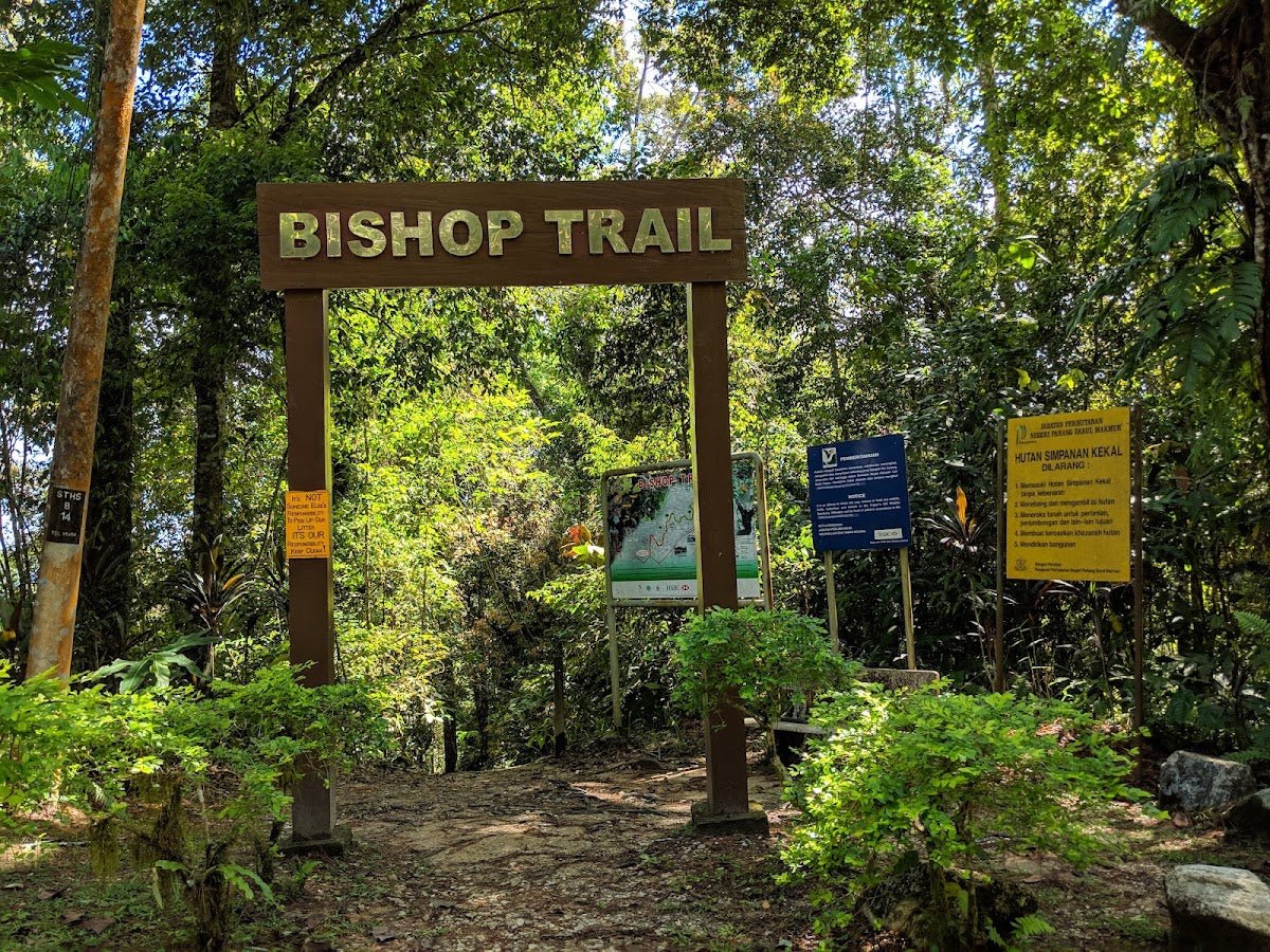
Gunung Santubong is on the Damai Peninsula, about 35 km north of Kuching — roughly 1 hour by road from the city centre. The two trailhead entry points are the Santubong Ranger Post on Jalan Sultan Tengah (for the Summit Trail) and Park HQ near Permai Rainforest Resort (for the Loop Trail).
Getting here: Hotel Grand Margherita Kuching runs a shuttle bus service to the area — worth checking if you're based in the city. Taxis run at around USD 15, and ride-hailing apps work from Kuching. Public buses pass through 2–3 times daily, which is workable but tight given the early registration windows. Renting a private vehicle gives you the most flexibility, especially if you want to arrive before 8 am on a weekend.
Parking is available at Santubong National Park, but note the daily limit of 50 hikers — slots fill up fast on weekends and public holidays. Arrive early. Once the quota is full, you're not getting on the trail that day, simple as that.

Permits & Fees
Registration is free — just give your name and phone number. No fees as of 2026, which is confirmed across multiple recent sources.
Where to register:
- Summit Trail: Santubong Ranger Post — weekends and public holidays 7–9 am; weekdays 8–9 am. Do not miss this window. On weekdays, if you're not registered by 9 am, you are not starting that day.
- Loop Trail: Park HQ — registration open until 12 pm.
The park is administered by the Sarawak Forestry Corporation (SFC). Park hours are 8 am–5 pm daily, and there is a hard daily limit of 50 hikers on the summit trail. Weekends can get crowded — one recent hiker noted that slots go quickly, so arriving right at opening time is not being kiasu, it's being smart.
Trail conditions and permit requirements change — always check with the local forestry office or park authority before you go. Or ask the TAHAN Hiking Community on WhatsApp — someone's usually been there that week. Checking a different gunung? Try our free permit checker — instant answer for 90+ Malaysian mountains.
The Trail: What to Expect
The Summit Trail is well-marked with checkpoint signboards (F-numbers) and colour-coded markers. The trail character changes dramatically as you gain elevation — what starts as a pleasant jungle walk becomes a serious technical climb in the upper sections. Here's what each stage actually looks like.

Stage 1: Park HQ to F7 — Flat Section and Lowland Jungle (1–1.5 hours)
The first 15 minutes from Park HQ are flat and stony, passing through two river crossings. These crossings sound easy on paper — and usually they are — but there have been reported cases of hikers becoming disoriented or lost around this section, so stay on the marked trail and don't wander. Leeches are present throughout the lower trail, though reportedly less active near the saltwater environment than in deep inland jungle. Still, tuck in your socks.
From the crossings, the trail enters a red-coded jungle section through the lowlands. This is the most comfortable part of the hike — shaded, relatively gradual, and a good chance to find your rhythm before things get serious. After 1 to 1.5 hours of this, you reach the F7 checkpoint.
Stage 2: F7 Checkpoint (Bukit Puteri) — Take a Breather Here
F7 is worth stopping for. You get panoramic views of Kampung Santubong, the coastal beaches, and the golf course below — proper views, not "squint through the trees" views. Many hikers who aren't going for the full summit turn back here, which is a completely reasonable call. If this is your first time on Santubong, or if you've been questioning your fitness on the way up, F7 is a dignified endpoint.
If you're continuing, rest here, eat something, check your water, and check the time. You need to be on your way down by 3 pm at the absolute latest (some guidance says 1 pm — get the current ruling from park staff when you register). Plan backwards from that cutoff.

Stage 3: F7 to F9 — Bigger Boulders, Ropes Begin
After F7, the trail steepens noticeably. You're now navigating larger boulders and using fixed ropes to pull yourself up. This is where people who underestimated Santubong start to regret their footwear choices — trail shoes or hiking boots with grip are not optional here, they're basic safety. Roots, mud, and uneven rock are constant. Take it steady and test each rope before you commit your weight to it.
Stage 4: F9 to F11 — Vertical Rope Ladders
This is the section that separates Santubong from your average jungle walk. Between F9 and F11, you hit fixed aluminium ladder sections on near-vertical rock faces — the highest ladder is roughly 2 storeys tall. If you have acrophobia, this is your honest warning: these ladders are exposed and there is real drop below you. It's manageable for most people, but not something to surprise yourself with. Go slow, three points of contact at all times, and don't rush anyone below or above you.

Stage 5: Summit at 810 m
You made it. The summit sits at 810 m and on a clear day you can see back towards Kuching. There's a small pond at the top — it's there only for emergencies, not for refilling your drinking supply casually. Eat, photograph everything, and then immediately start calculating your descent time. The mountain doesn't care about your summit selfie if you're still up here at 4 pm.

Descent & Safety
The descent on Santubong is not a formality. The ladder sections and roped boulders that challenged you on the way up are genuinely more dangerous coming down — wet rock, tired legs, and failing light are a bad combination. Give yourself as much time for the descent as you gave the ascent, possibly more.
Hard rule: start your descent no later than 3 pm. Some park guidance says 1 pm. Confirm the current cutoff when you register and stick to it. The park closes at 5 pm and being benighted on this trail is a real risk if you ignore the turnaround time.
Key hazards to stay aware of throughout the hike:
- Afternoon rain: Very common on Santubong. Weather deteriorates after morning hours. Wet ladders and wet ropes on the upper section are significantly more dangerous than dry ones.
- Slippery mud: Especially during and after rain. The lower jungle sections get very slick.
- River crossings: Straightforward in dry conditions; take care in high water and don't lose the trail markers.
- Fixed ladders: Aluminium gets slippery when wet. Go one at a time, don't crowd.
- Wildlife: Spiders and snakes have been reported, particularly in early morning. Watch where you put your hands on rocks and roots.
- Leeches: Present throughout, especially in wetter conditions. Do a check at every rest stop.
- No water on trail: No reliable water sources. If you run out, you're in trouble. Bring minimum 3 litres per person.
If the weather turns bad on the upper section, turn around. The views aren't worth a slip off a wet ladder. There's no heroism in pushing through bad weather on a near-vertical rock face.
What to Bring
Santubong is a hard, technical day hike with no water on trail, vertical ladders, and afternoon rain risk. Pack accordingly.
- Water: Minimum 3 litres per person. No exceptions. A hydration bladder like the TAHAN TrailBladder 2L keeps your hands free for the rope and ladder sections — very practical on this trail.
- Food: Energy snacks, sandwiches, something substantial for the summit. Isotonics are reportedly sold near the trailhead area but don't rely on it.
- Footwear: Trail shoes or hiking boots with real grip. Not sneakers, not sandals.
- Trekking poles: Useful especially on descent. The TAHAN 3-Section Foldable Hiking Stick V2 packs down small enough to stow when you hit the ladder sections — important because you need both hands free on the upper trail.
- Rain jacket: Compact, lightweight. Afternoon rain on Santubong is a when, not an if.
- Gloves: Light gloves help on the rope and ladder sections — the fixed ropes are rough on hands.
- Leech socks or gaiters: Or at minimum, tuck your socks over your trouser legs.
- First aid kit: Basics — plasters, antiseptic, blister care.
- Fully charged phone: For navigation confirmation and emergency contact. Download the trail on a maps app before you go.
- Headlamp: Even on a day hike. If something goes wrong and you're descending late, you'll want it.
For a broader rundown on what to pack for Malaysian mountain hikes, check out our hiking gear guide — covers everything from poles to knee support.
FAQ
How hard is Gunung Santubong?
Hard. It's officially rated "Challenging" and that's accurate. The lower jungle sections are manageable for reasonably fit hikers, but the upper trail — boulders, fixed ropes, and near-vertical aluminium ladders up to 2 storeys high — is genuinely demanding. If you haven't done much hiking before, go to F7 and turn back. That alone takes 1–1.5 hours one-way and gives you good views. Don't attempt the full summit as your first hike.
How long does Gunung Santubong take?
The full return trip takes most hikers 5–8 hours. One-way to the summit ranges from 2.5 hours for fast, fit hikers up to 6 hours for those taking it steady or dealing with the upper sections carefully. Plan for the slower end of the range if it's your first time, and always work backwards from the 3 pm (or 1 pm — confirm with park staff) turnaround cutoff.
Do I need a permit or guide for Gunung Santubong?
No paid permit and no guide required. You do need to register your name and phone number at the Santubong Ranger Post before starting the Summit Trail — free of charge. Registration windows are tight: weekdays 8–9 am only, weekends and public holidays 7–9 am. Miss that window and you're not hiking that day. No guide is needed as the trail is well-marked with checkpoint signboards.
What is the best time to hike Gunung Santubong?
The dry seasons — February to April and August to October — are your best bet. June to August is also cited by some as ideal. Avoid the rainy season; the upper trail becomes significantly more dangerous when wet. Regardless of season, start as early as possible. Afternoon rain is common and the upper ladders on a wet day are not where you want to be.
Camp Nearby?
Santubong doesn't allow overnight camping — it's day visits only, and you need to be off the mountain by 5 pm. But if you're making a Sarawak weekend of it, there are some good options in the region worth knowing about. Making a weekend of it? Check out EnChant Retreat & Glamping Telok Melano for a coastal glamping experience in Sarawak, or Lepau Uten Long Urun for a genuine jungle homestay and camping experience deeper in Sarawak. If you're exploring further up the coast, 91 Beach Campsite Miri is worth the trip. Staying somewhere the night before also means you can drive to the trailhead early and beat the registration queue — always a smart move on Santubong weekends.
Trail conditions, permit updates, and hiking buddies for the weekend — all in one WhatsApp group. Just ask; someone was probably up there last week.
💬 Join the Hiking CommunityFree, one click. No spam — the occasional promo at most.
Gear tip: How to use a trekking pole (and set the height).
Mike has been camping across Malaysia for over 10 years — from jungle treks in Taman Negara to beach camps in Perhentian. He writes about it so you don't have to find out the hard way. Follow along on TAHAN Outdoor's blog for honest campsite reviews, every week.
⛺ Featured in: The 7 Best Hikes in Sarawak (2026)