Gunung Nungkok: A Hiker's Guide (2026)
Gunung Nungkok doesn't get the same hype as its famous neighbour, but for hikers in Sabah who want a serious challenge without the crowds and costs of Kinabalu, this is one of the most rewarding climbs in the region. At 1,652 m, it's considered the 'Anak Kinabalu' — child of Kinabalu — and on a clear summit day, you'll see exactly why. The views of Mount Kinabalu from up top are genuinely breathtaking.

This is a hard hike. Dense, humid rainforest. Relentless leeches. Steep roped scrambles near the summit. A mandatory 10am turnaround deadline at the final rest point if you're not moving fast enough. That's not to scare you off — it's to make sure you show up prepared. This hike suits experienced hikers with solid fitness and mental grit. If you're new to hill hiking or still building stamina, come back after a few shorter climbs first.
The other thing that makes Nungkok special: the chance to see Rafflesia flowers in bloom about 2 km into the trail. The world's largest flowers only bloom for roughly one week at a time, so there's no guarantee — but the possibility alone makes the early alarm worth it. Add in eagles circling the north peak and you've got a pretty compelling case for making the drive out to Tambatuon.
Quick Facts
- Summit elevation: 1,652 m (5,420 ft)
- Elevation gain: 1,418 m (4,655 ft)
- Distance: 8 mi / 12.9 km out-and-back (core hike); up to 14 km if walking the full road section both ways without 4WD
- Duration: 6h 50m to 8h+ depending on fitness
- Difficulty: Hard
- Permit required: Yes — mandatory, through Tambatuon Eco Tourism Community
- Guide required: Yes — mandatory by law
- Recommended start time: 4am (hard 10am cut-off at Wosoi rest point)
- Best time to go: Year-round; dry season preferred for upper trail conditions and fewer leeches
Getting There & Parking
The trailhead is at Tambatuon village, about 72 km (44 miles) from Kota Kinabalu — roughly 2 hours by car. The drive takes you through a scenic valley road past farmland, rubber plantations, and paddy fields. There's no public transport serving Tambatuon, so you'll need to either drive yourself or book a private transfer.
Parking is available at the village. Once you arrive, you register and meet your guide at the Tambatuon Eco Tourism meeting point. From there, you're transported by 4WD vehicle to the actual starting point at 506 m. Worth noting: the road to the starting point can become impassable after heavy rain due to soil erosion. The 4WD service is optional (you can walk the 2.9 km road section), but honestly, save your legs — it's a long enough day as it is.

Permits & Fees
This is not a show-up-and-hike mountain. Permits are mandatory and must be arranged in advance through the Tambatuon Eco Tourism Community, which operates under approval from Sabah Parks.
- Climbing fee: RM116 for foreigners / RM76 for locals (includes registration, Sabah Parks fee, summit certificate, and a meal on return)
- Guide fee: RM200 per guide (covers up to 5 climbers)
- Optional 4WD to starting point: RM100 per vehicle (up to 6 people)
- Early start surcharge: RM30 per guide for a 2am start / RM20 per guide for 3am
- Late finish surcharge: RM10 per hour per guide after 5pm
To book, contact Mr Baruh at +6019-813 2853. Costs listed are current to May 2026 but may change — confirm when you book. Trail conditions and permit requirements change — always check with the local forestry office or park authority before you go.
The Trail: What to Expect
The route is an out-and-back with clearly defined waypoints. Your guide will know this trail, but you should know what's coming too. The 1,418 m of elevation gain is not evenly distributed — the upper stages are where it bites.

Eco Tourism Meeting Point to Starting Point (30 m to 506 m)
You register here, meet your guide, and load into the 4WD. If you're opting out of the vehicle, this is a 2.9 km walk along the road. Either way, once you reach the small shelter at 506 m, you get your first proper look at Nungkok — and Kinabalu in the background. Take a moment. The real climbing begins here.
Starting Point to Pangasaan (506 m to 595 m)
The opening section eases you in with a steady climb through forest. Trail signs at Pangasaan confirm you're on track. If you're starting at 4am, this section is in darkness — your headlamp earns its keep here, and this is exactly why a guide is mandatory. Junctions are easy to miss before dawn.
Pangasaan to Rafflesia Area (595 m to 758 m)
Around 2 km from the starting point, you hit the Rafflesia area. If there's one in bloom — and it's rare, roughly one week at a time — you'll smell it before you see it. Look, photograph, appreciate. Do not touch. These flowers are protected and fragile.

Rafflesia Area to Daayan (758 m to 798 m)
Past the Rafflesia zone, terrain starts getting rockier. Daayan marks the end of Stage 1 and signals that the softer forest walking is mostly behind you. Leeches are active throughout this lower forest section — check your socks and gaiters regularly, especially after wet weather.
Daayan to Ruminoo (798 m to 1,051 m)
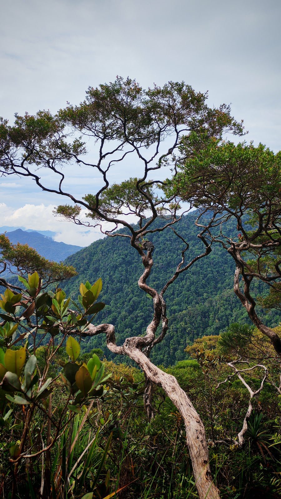
This mid-section climbs through an airy ridge at 994 m — one of the better viewpoint moments on the way up — before reaching the Ruminoo rest point at 1,051 m. Take a proper rest here. The gradient steepens ahead. There's a short col descent to 1,034 m after Ruminoo before the climb resumes — mentally prepare for losing a little elevation before earning it back.
Ruminoo to Wosoi (1,034 m col to 1,341 m)
Wosoi is the big one. At 1,341 m, this is the major rest point and the location of the hard 10am turnaround cut-off. If your group hasn't reached Wosoi by 10am, your guide will call the climb. No exceptions, no negotiations — this rule exists because the descent takes time and the trail is not one you want to be finishing in darkness without prior arrangement. Aim to hit Wosoi well before 10am. That means keeping your breaks short in the lower sections.

Wosoi to Summit (1,341 m to 1,652 m)
The final 500 m to the summit is the most physically demanding section. Steep roped scrambles, narrow ridge sections, exposure — this is where recent hikers are understating things when they say it's 'extreme challenging.' One described the trail as 'more difficult than expected — rocky and very steep.' Those accounts are accurate. The roped sections require upper body engagement, not just leg strength. If you have a fear of heights, the narrow ridge near the summit will test you.
There's a viewpoint at 1,410 m with coastal views worth a pause — then push on to the summit at 1,652 m. The panoramic view of Mount Kinabalu from the top, on a clear morning, is the payoff for everything you just climbed through.
Descent & Safety
Coming down Nungkok is not easy and should not be treated as the quick part. Wet roots and mossy rock make for treacherous footing, and the descent puts serious strain on your knees and toes. Descend deliberately, especially on the roped sections. Use the ropes going down too.
Key hazards to be aware of:
- Leeches: Relentless through the forest sections, especially in wet season. Not dangerous but prepare for it — bring leech socks or gaiters and salt/tobacco if that's your method.
- Steep roped sections near summit: Real exposure. Not suitable for those with severe fear of heights.
- Wet roots and mossy rock on descent: Major knee and toe strain. Trekking poles and knee support make a genuine difference here.
- River crossing near 4WD section: Heavy rain can swell the river and make the vehicle crossing dangerous. Your guide will assess conditions.
- Wind and falling trees: Your guide may advise pausing if conditions warrant. Listen to them.
- Dense humid rainforest throughout: Heat and humidity are relentless. Pace yourself early.
If weather turns bad — heavy rain, thick cloud, strong wind — trust your guide's call on whether to continue. The 10am Wosoi cut-off exists precisely because this mountain does not forgive poor timing on the descent.

What to Bring
Water first: sources on the upper trail are very limited and not available on the higher slopes. Bring enough bottled water for the full day — do not rely on finding water above Daayan. A TAHAN TrailBladder 2L Water Bladder keeps water accessible without stopping to dig through your pack, which matters when you're focused on footing in the dark.
For the descent, your knees will feel every metre of that 1,418 m of elevation loss on steep, root-covered ground. A pair of TAHAN Kinetix Knee Guards with Spring Support takes meaningful pressure off the joint — I'd call these non-optional for anyone with a history of knee trouble, and worth it for everyone else on a descent like this.
Full packing list for Nungkok:
- Headlamp with fresh batteries (a 4am start means at least 2 hours of darkness)
- Sufficient water for the full day — upper slopes have no reliable water
- High-energy food: energy bars, nuts, bananas — food you can eat on the move
- Trekking poles — the roped scrambles and root-covered descent demand them
- Leech socks or gaiters (non-negotiable in wet season)
- Knee support for the descent
- Rain jacket — the forest can get very wet and the summit is exposed
- Dry bag or waterproof pack cover
- First aid basics: blister plasters, antiseptic, muscle relief
- Fully charged phone (offline maps downloaded as backup)
For a broader breakdown of what to look for in poles and knee protection for Malaysian trails, check out our hiking gear guide.
FAQ
How hard is Gunung Nungkok?
It's rated Hard, and that rating is honest. The 1,418 m of elevation gain, steep roped scrambles near the summit, dense humid jungle, and relentless leeches add up to a genuinely demanding day. Multiple hikers with experience rate it harder than they expected. If you're regularly completing 6+ hour hikes with significant elevation, you're in the right ballpark. Beginners without solid stamina should not attempt this.
How long does Gunung Nungkok take?
Most hikers complete it in 6h 50m to 8h+, depending on fitness. An early start — the community recommends 4am — is strongly advised to ensure you reach the Wosoi rest point (1,341 m) before the hard 10am cut-off. Miss that cut-off and your guide will turn you around, summit or not.
Do I need a permit and guide for Gunung Nungkok?
Yes to both, and both are mandatory. The permit is arranged through the Tambatuon Eco Tourism Community (approved by Sabah Parks), and a licensed guide is required by law. The guide isn't just a formality — junctions on this trail are easy to miss in darkness, and the upper stages are not suitable for solo navigation. Contact Mr Baruh at +6019-813 2853 to book. Advanced booking is required.
Can I see Rafflesia flowers on this hike?
Possibly — there's a dedicated Rafflesia area about 2 km from the starting point at 758 m. But these are wild flowers that only bloom for roughly one week at a time, so there's no guarantee. Check with the Tambatuon Eco Tourism contact when booking — they'll know if there's an active bloom.
Camp Nearby?
Making a weekend of it? Given the 4am start, an overnight stay near Tambatuon makes a lot more sense than a 2am drive from KK. The Sabah interior has some solid options worth considering. For a proper rainforest experience, Tungog Rainforest Eco Camp, Sabah is a strong choice — close to nature and genuinely immersive. If you'd rather base yourself closer to Kota Belud on the way in or out, Dingin Batu Campsite, Kota Belud is a solid campsite option, or if you want something a bit more comfortable after a hard day's hiking, Nulinau Glamping Garden, Kota Belud gives you a bed and a bit of comfort when your knees are asking for one.
Mike has been camping across Malaysia for over 10 years — from jungle treks in Taman Negara to beach camps in Perhentian. He writes about it so you don't have to find out the hard way. Follow along on TAHAN Outdoor's blog for honest campsite reviews, every week.