Gunung Kajang, Tioman: A Hiker's Guide (2026)
Gunung Kajang is not your typical Malaysian trail. This is the highest island mountain in Malaysia — 1,038 metres rising straight out of the South China Sea on Pulau Tioman — and it earns every bit of its reputation. Known historically as 'Palm Frond Mountain', it was used as a navigational landmark by seafarers for centuries. Today it draws hikers who want something genuinely wild, genuinely remote, and genuinely hard.

This is a Very Difficult hike. The trail sees infrequent traffic, maintenance is inconsistent, ropes are involved, leeches are guaranteed, and conditions on the upper ridge can change fast. It suits experienced hikers who are comfortable with jungle navigation, steep technical ascents, and the reality that help is not close by. If you're looking for a well-groomed trail with clear signage every 500 metres, Gunung Kajang will humble you. If you want dense jungle, a boulder-filled valley, a cloud-wrapped ridge, and a triangulation station at the top of an extinct volcano on a tropical island — this is it.
Solo hiking here is strongly discouraged. Get a local guide. More on that below.
Quick Facts
- Summit elevation: 1,038 m above sea level
- Trail distance: 11.82 km (some GPS tracks record 13.4 km — depends on route variation)
- Elevation gain: approximately 1,028–1,065 m
- Estimated duration: 5 hours if trail is recently maintained; 7+ hours if overgrown — highly variable, plan for the longer end
- Difficulty: Very Difficult
- Trailhead: Kampung Paya, Pulau Tioman, Pahang
- Permit required: No specific hiking permit as of 2022, but marine and island entry fees apply (see Permits section)
- Guide required: Not legally mandated, but strongly recommended — solo hiking strongly discouraged
Getting There & Parking
Getting to Gunung Kajang starts well before the trailhead. You need to get to Pulau Tioman first, which means taking a ferry from Mersing, Johor. The ferry drops you on the island, and from there you make your way to Kampung Paya, where the trail begins. Kampung Paya is one of the villages along the western coast of Tioman — you can get there by water taxi from other villages, or arrange accommodation nearby.
For parking: if you're driving from KL or elsewhere on the peninsula, you'll leave your car at the Mersing jetty ferry parking area. On Tioman itself, parking is essentially whatever your guesthouse or accommodation provides — it varies. There is no trailhead car park in the conventional sense. Factor in your ferry schedule when planning your start time; an early ferry means an earlier start on the trail, which matters a lot on a hike this long.

Permits & Fees
There's no dedicated hiking permit for Gunung Kajang as of 2022, but you will still pay to enter Tioman's waters and the island itself. Here's the breakdown from the facts available:
- Marine park entry fee: RM30 for foreigners, RM5 for Malaysians — collected at the ferry terminal
- Tioman island fee: RM3, collected at your accommodation on arrival
- Guide fees: Local guides are available on-island; rates are negotiated directly with them — no fixed price is listed anywhere, so ask around when you arrive at Kampung Paya
The permit situation for hiking Tioman's interior is less formalised than mainland Pahang trails, but that doesn't mean you treat this as a free-for-all. The state forestry department oversees the island, and requirements may have changed since 2022. Trail conditions and permit requirements change — always check with the local forestry office or park authority before you go.
The Trail: What to Expect
The Paya trail is the main route up Gunung Kajang. It's a jungle ridge slog with technical sections, natural water points, and a summit push that demands proper grip and some rope work. Here's what you're walking into, stage by stage.
Kampung Paya Trailhead
The trail starts from the village of Kampung Paya. Get your kit sorted here — leech socks on before you even enter the tree line, not after. The first section is a warm-up into dense secondary jungle, but don't let it fool you. The trail condition from this point on depends heavily on when it was last cleared. If it's been a while, expect overgrown sections where the path is more suggestion than fact. This is exactly why a local guide earns their fee.

Mother Willow Tree (2.7 km)
An early landmark at 2.7 km in. The Mother Willow Tree is one of those trail markers that feels significant — and on a route this infrequently travelled, any clear landmark is worth acknowledging. Use it as a checkpoint to check your pace and hydration. You've barely started the elevation gain at this point.
Water Point 1 (299 m elevation)
First natural water point on the trail. At 299 metres elevation, you haven't gained much yet — but this is your last confirmed resupply point before the terrain starts to steepen. Treat the water before drinking. Don't assume it's safe just because it's flowing.
Water Point 2 (627 m elevation)
By the time you hit Water Point 2 at 627 metres, you'll feel the ascent properly. The terrain between the two water points gets progressively steeper and muddier. This is also where leeches are at their most aggressive — on wet days, they'll find you regardless of what you do, but leech socks and gloves make a real difference. Refill here if needed.

Bukit Senyum
Bukit Senyum — 'Smiling Hill' — sits along the ridge before the base camp push. The name is somewhat ironic because by this point, the jungle is dense, the footing is demanding, and the ridge line can be foggy. Stay on the path, watch your footing on exposed roots and slippery rock faces, and don't rush this section.
Base Camp (800 m elevation)
At 800 metres, base camp is where overnight parties would set up before a summit push the next morning. If you're doing this as a day hike, this is your last rest point before the final climb. Check your water, eat something, and assess conditions above you. If there's thick fog and rain incoming, this is a serious decision point about whether to continue.

Summit — Triangulation Station (1,038 m)
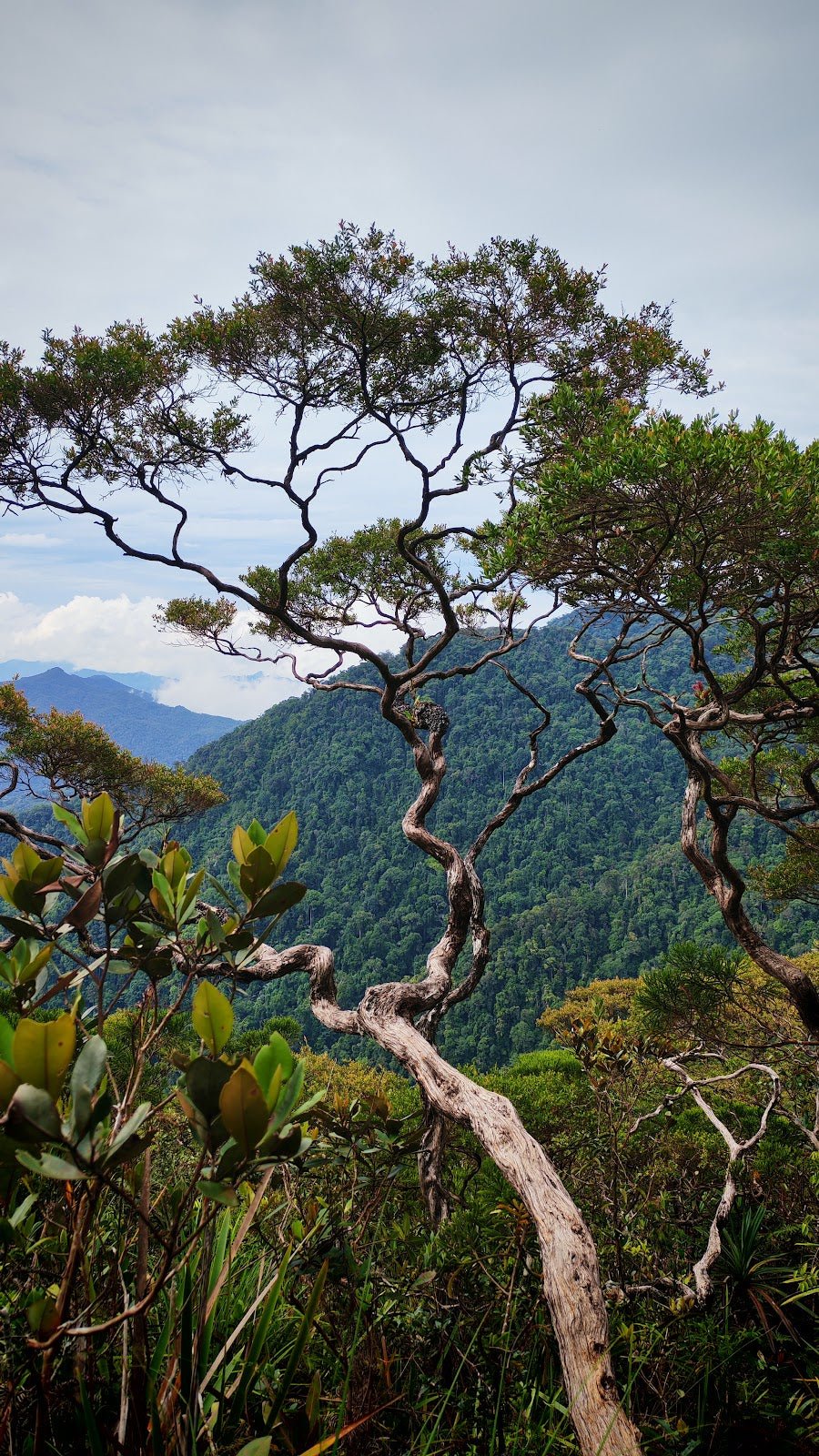
The final push from base camp to the summit is the hardest section of the trail. Very steep ascent with ropes to help cross chasms and navigate the steepest faces. Take your time, use the ropes properly, and don't take shortcuts on the descent route mentally — you'll need to remember this section on the way back down. At the top, the triangulation station marks the true summit. On a clear day, the views over Tioman and the South China Sea are worth every leech bite. On a foggy day, you'll know you were there.

Descent & Safety
Coming down Gunung Kajang is where most incidents happen. The steep sections near the summit are slippery even in dry conditions, and on wet rock they're genuinely dangerous. Take the ropes on descent the same way you took them on ascent — controlled, one at a time, weight distributed properly.
Real cautions to take seriously:
- Leeches: Major, persistent hazard throughout the entire trail. Leech socks and gloves are not optional extras — bring them.
- Rope sections: Required to cross chasms. If ropes are old or frayed, test before committing weight. Your guide should know the current state of them.
- Very steep summit section: High risk of slipping, especially on descent. Trekking poles help significantly here.
- Trail condition: Poor maintenance means unmarked trail in sections. If you lose the path, stop. Don't keep moving in the wrong direction hoping it sorts itself out.
- Mud and slippery conditions: After any rain, sections become treacherous. This is a tropical island — rain is never far away.
- Fog at higher elevations: Visibility on the upper ridge and summit can drop fast. Navigation becomes harder.
- Remoteness: You're on an island jungle trail with infrequent traffic. Emergency evacuation is complicated. This is not the place for a twisted ankle to turn into a casualty situation because you pushed on.
Turn back if: weather deteriorates significantly on the upper ridge, if anyone in your group is struggling badly before base camp, or if it's getting late and you haven't reached base camp yet. The trail does not get easier. There is no shortcut out.
What to Bring
Pack for a long, hot, wet jungle day on a remote island. This is not a trail where you cut corners on gear.
- Leech socks and gloves: Non-negotiable. Seriously.
- Trekking poles: The steep descent alone justifies them. The TAHAN 3-Section Foldable Hiking Stick V2 packs down small enough for the ferry journey and gives you solid support on the technical sections — I rate this for exactly this kind of jungle-ridge terrain.
- Knee support: Over 1,000 metres of elevation gain and descent on steep muddy trail puts real stress on your knees. The TAHAN Kinetix Knee Guard With Spring Support is worth packing if your knees have any history of complaints.
- Water — at least 2–3 litres: There are two water points on trail, but treat water before drinking. Don't rely on them as your only source.
- Food: High-energy snacks for the full day. This is a 5–7+ hour hike — fuel accordingly.
- Rain gear and dry bags: Tropical island. It will rain. Everything electronic or dry needs to stay dry.
- Headlamp: If you're running long, you may be descending in low light. Carry one regardless.
- First aid kit: Basics plus blister care, antiseptic for leech wounds, and any personal medication.
- Fully charged phone with offline maps downloaded: Signal on the upper trail is unreliable.
For a full breakdown of gear worth carrying on Malaysian mountain trails, have a read of our hiking gear guide — covers what's actually useful versus what just adds weight.
FAQ
How hard is Gunung Kajang?
Very Difficult — and that's not an exaggeration. The elevation gain of over 1,000 metres on a trail that's infrequently maintained, with rope crossings, steep summit sections, and persistent leeches throughout, puts this firmly in the serious hike category. Don't attempt it without solid jungle hiking experience and a local guide.
How long does Gunung Kajang take?
Highly variable. If the trail has been recently cleared and maintained, fit hikers report around 5 hours return. If it's overgrown — which is common — budget 7 hours or more. Plan for the longer estimate and start as early as possible. Do not start this hike late morning.
Do I need a permit to hike Gunung Kajang?
No specific hiking permit was required as of 2022. However, you do need to pay the marine park fee (RM30 foreigners / RM5 Malaysians) at the ferry terminal and a RM3 island fee at your accommodation. Requirements may have changed — check with the forestry department or your accommodation on Tioman before heading to the trailhead.
Do I need a guide for Gunung Kajang?
It's not legally required, but solo hiking is strongly discouraged. The trail is poorly maintained in sections, infrequently used, and the rescue situation from an island jungle is complicated. Local guides are available on Tioman — find one in Kampung Paya. Their fee is negotiated directly; ask around when you arrive.
Camp Nearby?
Gunung Kajang is its own adventure, but if you're looking to make a full Pahang hiking weekend of it, there are solid campsite options on the peninsula worth knowing about. Making a weekend of it? Woodstock Camp Janda Baik is a favourite for a jungle camping fix closer to KL, and Glamping Valley @ Janda Baik works well if your group has mixed comfort preferences. Camp Mantap, Bentong is another solid option if you want to stay in Pahang before or after the island trip. None of these are on Tioman, of course — but for an early departure night before your Mersing ferry, they're worth considering over a random roadside hotel.
Mike has been camping across Malaysia for over 10 years — from jungle treks in Taman Negara to beach camps in Perhentian. He writes about it so you don't have to find out the hard way. Follow along on TAHAN Outdoor's blog for honest campsite reviews, every week.