Gunung Bunga Buah: A Hiker's Guide (2026)
Gunung Bunga Buah sits roughly halfway up the road to Genting Highlands, tucked behind the quiet streets of Gohtong Jaya. At 1,430–1,441 m, it's one of the more rewarding day hikes in Selangor — not because the peak is anything special, but because the Rock Garden at 1,249 m delivers views that'll stop you mid-sip from your water bottle. Think sweeping vistas across the Genting Highlands range, and on clear days, all the way to the Malaysian coastline.

This is a moderate to moderately hard trail. Steep in sections, consistently muddy, overgrown with roots and thorny plants throughout — it's not the place to bring someone on their first hike ever. But if you've done a few trails and know what you're getting into, Gunung Bunga Buah is genuinely worth it. The upper elevations open into mossy forest with bonsai-like trees, cold mist, and the kind of quiet that's hard to find this close to a casino resort.
IMPORTANT — Read This First: As of February 2026, Gunung Bunga Buah is closed for recreational activities indefinitely due to construction in the Gohtong Jaya area. The original trail was closed by a private entity, and while hikers have opened an alternate route, its status remains uncertain. Before you plan anything, verify current access with the relevant authorities. Do not just show up and assume the trail is open.
Quick Facts
- Peak elevation: 1,430–1,441 m
- Trailhead elevation: ~922 m
- Elevation gain: 500–1,077 m depending on route and starting point
- Distance: Sources vary — AllTrails reports 11.6–12.1 km; other sources cite 7.2 km one-way or up to 14 km total. Plan for a full day regardless.
- Duration: 3.5–4 hours ascent; 2–2.5 hours descent; 6–8 hours round trip depending on fitness and time at viewpoints
- Difficulty: Moderate to Moderately Hard — steep sections, muddy trail, tree roots, overgrown vegetation. Not for beginners.
- Permit: Complicated — see section below
- Trail status (Feb 2026): CLOSED indefinitely. Confirm before going.
Getting There & Parking
The trailhead is in Gohtong Jaya, the small town sitting roughly halfway up the Genting Highlands road. You're looking for the area near Hotel Seri Malaysia Genting. From the last shop on Jalan Jati 1, turn right — the trail begins near a Taoist statue in a small hut. You'll likely see a red "private property" sign; local practice has been to proceed past it, but given the current closure status, treat this as extra reason to confirm access before you go.
For parking, the recommended spot is F30 Chinese restaurant (Foodtaste Thirty) in Gohtong Jaya — some hikers actually enter via the Datuk's hut behind the restaurant. Parking coupons are available from local shops. Spots are limited, so arrive early if access is ever reopened. One more thing worth knowing: a planned Breez Hill development in the area may affect future access further — another reason to check current conditions before making the trip.

Permits & Fees
This one's genuinely complicated. Gunung Bunga Buah sits on private land — it's not a government-managed forest reserve — so there's no official forestry permit process specifically for this mountain. However, Selangor's forestry regulations state that a permit is mandatory for hikes at elevations of 600 m and above, obtainable via the SEFOREST portal at forestry.selangor.gov.my/permit/home at RM5 per person (as of April 2025). Whether that technically applies here given the private land status is unclear — but when in doubt, get the permit. RM5 isn't worth the risk of getting caught without one.
On guides: Selangor regulations also make guides mandatory for hikes at 600 m elevation and above. Guide availability for Gunung Bunga Buah specifically is unconfirmed, so you'll need to call ahead. Try the Hulu Selangor Malim Association at 019-9194471 or the Selangor Forestry Mountain Guide Association at 018-9741651.
Trail conditions and permit requirements change — always check with the local forestry office or park authority before you go. Or ask the TAHAN Hiking Community on WhatsApp — someone's usually been there that week. Checking a different gunung? Try our free permit checker — instant answer for 90+ Malaysian mountains.
The Trail: What to Expect
The route climbs from Gohtong Jaya through dense tropical rainforest, hitting a series of checkpoints before reaching the Rock Garden and eventually the summit. The trail is narrow, often overgrown, and will test your footing throughout. Here's how it breaks down.

Trailhead to Old Road Sign (~1 hour)
The first stretch from the trailhead gets you to the real trail start at around 1,128 m. Don't underestimate this section — despite being the "approach," the first 650 m or so involves a steep, slippery climb that some hikers find tougher than anything that comes later. Trail markings can be sparse. Stay alert and follow established footprints where possible.
Steep Ascent to Minor Peak (1,164 m)
Once past the old road sign, the trail gets serious. You're climbing steeply through muddy terrain with tree roots and thorny vegetation on both sides. This is where a hiking stick earns its keep — there are no ropes to assist. Watch every step. The minor peak at 1,164 m gives you a brief psychological win before the trail throws its next move.
Descent to Col (1,059 m)
Yes, you come down significantly after the minor peak — dropping to a col at 1,059 m. This kind of descent mid-hike is always a morale test because you know you're going to have to earn that elevation back. The ground here can be particularly slippery on the way down.
Checkpoint 1 (1,105 m) — 20 minutes from Col
About 20 minutes of climbing from the col brings you to Checkpoint 1 at 1,105 m. Between Checkpoint 1 and Checkpoint 2, there's a water source available off-trail to the left if you need to top up. Treat any water from jungle sources before drinking.
Water Source Sign (1,148 m) to Checkpoint 2 (1,226 m) — ~20 minutes
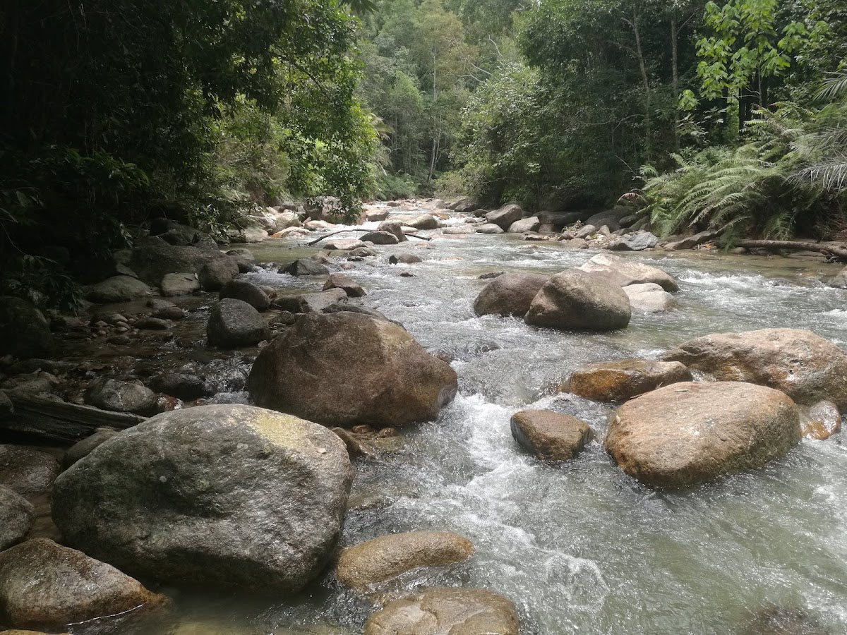
You'll pass a sign marking the water source at 1,148 m, then push on to Checkpoint 2 at 1,226 m — roughly 20 minutes past the water source marker. By this point you're into the upper reaches of the trail, and the vegetation starts shifting. The mossy forest begins to reveal itself: spongy underfoot, bonsai-like trees, cold air, the works.

Rock Garden (1,249 m) — ~60 minutes from Checkpoint 2
This is the highlight of the whole hike for most people, and honestly it's easy to see why. The Rock Garden at 1,249 m is a rocky outcrop with sweeping views across Genting Highlands and the surrounding mountain range — scenery that reportedly rivals Bukit Kutu. On clear days you can see all the way to the coast. Before reaching the Rock Garden, look out for the Last Water Point branch going left — this is your final reliable water opportunity on the trail. The Rock Garden is about 30 minutes past that branch.
Rock Garden to Summit (1,430–1,441 m) — ~1 hour
The final push from the Rock Garden to the summit takes roughly an hour. Fair warning: the actual peak has limited scenic value compared to the Rock Garden. Many experienced hikers treat the Rock Garden as the main event and the summit as a formality. That said, if you've come this far, tag it.

Descent & Safety
The descent on Gunung Bunga Buah takes 2–2.5 hours and is slower and more treacherous than on most Malaysian peaks. The mud that was slippery on the way up doesn't get better going down. Roots you stepped over on the ascent become ankle-rolling hazards when you're tired and gravity is involved. Take your time. There's no prize for rushing.
Real hazards to keep in mind:
- Leeches: Abundant, especially after rain. Wear long socks, long pants, and gaiters. They will find the gaps if you give them gaps.
- Mud and slippery terrain: Persistent throughout, steep sections on both ascent and descent.
- Overgrown trail with thorny plants: Narrow trail that can close in on you. Long sleeves help.
- No ropes in most sections: You're relying on tree roots and your own footwork to manage steep sections.
- Navigation: Trail can be difficult to follow when vegetation is overgrown. Stick to the marked path, bring a downloaded offline map.
If weather turns bad, turn back. This trail is muddy on a good day — in rain, it becomes genuinely dangerous, and the leech situation gets significantly worse. Start early (by 7 am at the latest) to give yourself enough buffer before afternoon thunderstorms roll in.
What to Bring
- Hiking stick: Non-negotiable for this trail. The steep descents and muddy sections are rough on knees and balance. The TAHAN 3-Section Foldable Hiking Stick V2 (RM99) is compact enough to pack and sturdy enough to actually rely on — I've seen too many people here trying to manage with a random branch.
- Knee support: That mid-hike descent to the col plus the long way back down adds up. If your knees are an issue, consider the TAHAN Kinetix Knee Guard With Spring Support (RM79) — the spring support takes real load off on steep descents.
- Water: Carry at least 2–3 litres. The water sources on trail are off-trail and require treatment. Don't count on them.
- Gaiters and long socks: Essential for leech defence, not optional.
- Long pants and long sleeves: Thorny vegetation, leeches, and sun protection.
- Trail shoes with good grip: This is not the trail for road runners or flat-soled sneakers.
- Snacks and lunch: 6–8 hours is a long day — fuel matters.
- Headlamp: Start early, but if you're slow, you don't want to be descending this trail in the dark without one.
- Offline map: Download the route before you go. Signal can be spotty.
- First aid kit: Basics at minimum.
For more on choosing the right gear for Malaysian hill hikes, check out our hiking gear guide.

FAQ
How hard is Gunung Bunga Buah?
Moderate to moderately hard. The trail has persistent mud, steep sections, exposed roots, overgrown vegetation, and a significant descent mid-route that you have to re-climb. It's not suitable for absolute beginners. If you've done a handful of Malaysian jungle trails and are reasonably fit, you can handle it — but don't underestimate it.
How long does Gunung Bunga Buah take?
Most hikers report 3.5–4 hours up and 2–2.5 hours down — so 6–8 hours round trip including time at the Rock Garden and summit. That's consistent across multiple sources. Budget the full day and start by 7 am.
Do I need a permit for Gunung Bunga Buah?
Officially, Selangor regulations require a permit for hikes at 600 m elevation and above (RM5 via the SEFOREST portal). The mountain is private land rather than a government forest reserve, which creates some ambiguity, but the safe call is to get the permit. You also technically need a registered guide under Selangor regulations — call 019-9194471 (Hulu Selangor Malim Association) or 018-9741651 (Selangor Forestry Mountain Guide Association) to check availability.
Is Gunung Bunga Buah open in 2026?
No — as of February 2026, the mountain is closed indefinitely due to construction activity in Gohtong Jaya. The original trail was closed by a private entity, and an alternate route was opened by hikers but its status is uncertain. Do not plan a trip without confirming current access first. Call the guide associations above or check with Selangor Forestry for the latest.
Camp Nearby?
Making a weekend of it? Gunung Bunga Buah is a long day and an early start is key — staying nearby the night before makes a real difference. If you're looking for options around the Selangor region, we've reviewed a few worth considering: Mori Leka Campsite, Serendah is a solid jungle camp option not too far out, Nature Escape Campsite, Hulu Langat is worth a look if you're coming from the Hulu Langat side, and Templer Park Rainforest Retreat is a great base if you want something more established. None of these are walking distance to the trailhead, but they beat a 4 am drive from KL.
Trail conditions, permit updates, and hiking buddies for the weekend — all in one WhatsApp group. Just ask; someone was probably up there last week.
💬 Join the Hiking CommunityFree, one click. No spam — the occasional promo at most.
Gear tip: Water bladder or bottle on a humid trail.
Mike has been camping across Malaysia for over 10 years — from jungle treks in Taman Negara to beach camps in Perhentian. He writes about it so you don't have to find out the hard way. Follow along on TAHAN Outdoor's blog for honest campsite reviews, every week.