Gunung Besar Hantu: A Hiker's Guide (2026)
Gunung Besar Hantu — literally "Big Ghost Mountain" — is the highest peak in Negeri Sembilan at 1,462 metres, and it earns both the elevation and the name. The Orang Asli believe this mountain is home to ghouls and ghostly creatures, and honestly, when you're deep in dense jungle at 3am with mist rolling in, you start to understand the feeling. This is a proper hard hike: long, muddy, with river crossings, rope sections, and a bamboo bridge that will test your nerves. Not a beginner mountain. Not even close.

The trail runs through Taman Negeri Kenaboi in Jelebu, a protected state forest that rewards the effort. About a kilometre before the summit, you hit mossy forest — quiet, green, and carpeted with helmet orchids (Corybas) growing straight out of the moss. On a clear day at the top, you can see all the way to KL city and Genting Highlands. That view is earned. Most hikers report 8-10 hours total on trail, and some push well beyond that. Budget your day accordingly.
This guide is for hikers who already have some jungle experience — think Nuang or Datuk level — and want to know exactly what they're getting into before committing. If you've never done an overnight or a full-day jungle hike before, do those first.
Quick Facts
- Elevation: 1,462 m
- Distance: Approximately 16–17.7 km round trip (sources vary)
- Elevation Gain: Approximately 1,300–1,660 m (sources vary)
- Duration: 8–10 hours total (some hikers report up to 13 hours; plan for the longer end)
- Difficulty: Hard / Semi-hardcore — requires good fitness and prior hiking experience
- Permit Required: Yes — RM5 for Malaysians, RM20 for foreigners
- Guide Required: Yes — mandatory from 1 October 2025 onwards
- Trailhead: Taman Alam Liar Negeri Kenaboi, Jelebu, Negeri Sembilan
- Drive from KL: Approximately 2.5 hours
Getting There & Parking
The trailhead is at Taman Alam Liar Negeri Kenaboi (also called Taman Negeri Kenaboi) in the Jelebu district of Negeri Sembilan, about 2.5 hours from Kuala Lumpur. The road into Kenaboi State Park can be a bit of an adventure on its own, so most groups convoy in — the standard meeting point is the Petronas station in Kuala Klawang before heading in together. If you're going solo or with a small group, link up with your guide from there.
Parking at the trailhead is free. The Taman Alam Liar Negeri Kenaboi base has proper facilities: toilets, bathrooms, chalets, a surau, campsites, and the permit counter. So you can arrive the night before, rest up, and start early — which is honestly the smart move for a 9-10 hour hike.

Permits & Fees
A permit is required from Negeri Sembilan Forestry (Pejabat Hutan Daerah, Negeri Sembilan Utara). The fee is RM5 for Malaysians and RM20 for foreigners. The permit counter at the trailhead opens around 8am, but online purchasing is available if you want to get an earlier start — which you should, given the trail length.
As of 1 October 2025, a guide is mandatory by state forestry regulation. You can hire one through Persatuan Malim Gunung Negeri Sembilan. Even before this rule came in, experienced hikers strongly recommended guides here because there are multiple junction trails — to Lata Kijang waterfall, Lata Dinding, and Gunung Kecil Hantu — and it's easy to take a wrong turn. The rule is there for good reason.
Contact the forestry office directly: Pejabat Hutan Daerah, Negeri Sembilan Utara, Kuala Klawang, Jelebu, 71600. Tel: +60 6 136 500. Email: ekopelancongan@ns.gov.my.
Trail conditions and permit requirements change — always check with the local forestry office or park authority before you go. Or ask the TAHAN Hiking Community on WhatsApp — someone's usually been there that week. Checking a different gunung? Try our free permit checker — instant answer for 90+ Malaysian mountains.
The Trail: What to Expect
This trail doesn't ease you in. From the first kilometre, you're climbing. Here's what the route looks like stage by stage.

Stage 1: Parking Area to Trailhead (1.4 km / 128 m elevation gain)
You start at around 336 m elevation. The first 1.4 km from the parking area to the actual trailhead is a steady incline that immediately sets the tone. This is where you find your rhythm — and if you're already huffing here, that's information worth paying attention to. The forest closes in quickly and the trail starts feeling serious from the beginning.
Stage 2: Y-Junction — Left or Right
You'll hit a Y-junction early on. Left goes to Lata Kijang waterfall — a popular detour but not your destination today. Take the right fork for Gunung Besar Hantu. This is one of the junctions where hikers without a guide have gone wrong before. Stay right.
Stage 3: Sungai Kering Junction (652 m)
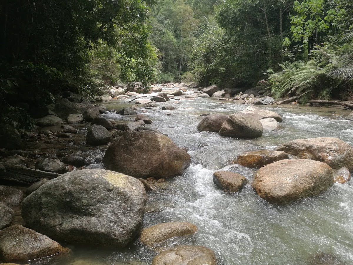
The name means "dry river" but don't let that fool you — Sungai Kering is actually your main water source on this trail. Fill up here and drink well. After this point, reliable water sources are scarce. For a nearly 20 km day with serious elevation gain, you need more water than you think you do. There are also two river crossings along the route — be careful on wet crossings, especially after rain.
Stage 4: Kem Orkid / Camp Orchid (935–1,018 m)
Kem Orkid is the main rest and camping point on the trail, reached roughly 2 hours after the Sungai Kering junction. This is where many overnight hikers set up camp. If you're doing a single-day push, this is your halfway breather. From here on, the terrain gets muddier — especially in the rainy season. There's water available just off the right side of the trail just past camp, but Sungai Kering remains the more reliable source. The sections above Orchid Camp involve crawling on roots, using ropes, and navigating genuinely slippery ground. This is not the place to discover your waterproof boots aren't actually waterproof.

Stage 5: Main Ridge Junction (1,331 m)
You emerge onto the main ridge at 1,331 m. Here the trail splits again — left goes toward Gunung Kecil Hantu (1,354 m), which is currently closed to the public due to hazardous vertical rock face terrain. Don't go left. Take the right fork toward Besar Hantu summit. There's no shortcut and no glory in going to a closed peak with a vertical drop.
Stage 6: Summit of Gunung Besar Hantu (1,462 m)
From the junction, it's approximately 700 metres to the summit — and this final stretch is actually less brutal than what came before. The mossy forest here is genuinely special: quiet, ancient-feeling, with helmet orchids (Corybas) growing in the moss underfoot. The trig station at the summit has collapsed, but the summit sign is hanging on a tree nearby. On a clear day, the views stretch out to KL's skyline and Genting Highlands. Worth every step.

Descent & Safety
Coming down Gunung Besar Hantu is not the relief it might sound like. The same muddy sections that slowed you on the way up are now working against your knees and your footing. The rope sections require just as much attention descending as ascending. River crossings are trickier with tired legs.
Key hazards to be aware of throughout:
- Mud — especially above Kem Orkid and worse in rainy season; assume it will be muddy
- Two river crossings — slippery rocks, stronger current after rain
- Bamboo bridge crossing — it's a highlight of the trail but treat it with respect; it moves
- Root and rope sections — require actual crawling in places; gloves help
- Multiple junctions with side trails that can lead you off-route (Lata Kijang, Lata Dinding, Gunung Kecil Hantu)
- Gunung Kecil Hantu (1,354 m) — closed, hazardous vertical rock face; do not attempt
- Dehydration — no reliable water after Sungai Kering at 652 m
If weather turns bad — and it can change fast in the jungle — turn back without ego. A summit you didn't reach is a story. An evacuation from a remote jungle trail in NS is a much worse one. Start early, set a hard turnaround time before you leave the carpark, and stick to it. This hike has a real emergency contact: +60 6 136 500 (Pejabat Hutan Daerah).
What to Bring
Pack for a full hard day in tropical jungle. Here's what this specific trail demands:
- Water: Minimum 3 litres from the start; more if you run hot. A hydration bladder lets you drink on the move without stopping — the TAHAN TrailBladder 2L fits most packs and makes a real difference on a 9-10 hour push.
- Trekking poles: Non-negotiable on this terrain. The muddy descents and river crossings are much safer with poles. The TAHAN 3-Section Foldable Hiking Stick V2 folds down when you need both hands for ropes and opens back up fast.
- Headlamp with spare batteries: If you start before dawn (many do, given the length), or if you're still descending after 6pm, you need this.
- Rain gear and dry bags: Assume rain. Assume mud. Keep electronics and dry clothes in dry bags.
- Gloves: The root and rope sections make gloves practical, not optional.
- Food: This is a 9-10 hour day minimum. Bring more than you think you need.
- First aid basics: Blister kit, antiseptic, bandages — jungle trails are unforgiving on cuts.
- Waterproof boots with grip: Trail runners can work for experienced hikers, but proper ankle support helps on the uneven terrain here.
For a fuller breakdown of what to look for in poles and knee support for Malaysian jungle hikes, check out our hiking gear guide.
FAQ
How hard is Gunung Besar Hantu?
Hard. Officially rated as Hard by AllTrails, described as semi-hardcore by local hiking communities. It's rated 6/10 difficulty and is explicitly not suitable for inexperienced hikers. If your longest previous hike was Bukit Tabur or a casual hill walk, this is not your next step. Come here after you've done Gunung Nuang or something similar. The mud, the rope sections, the distance, and the elevation gain combined make this a full commitment.
How long does Gunung Besar Hantu take?
Most hikers report 8–10 hours total, with 9–10 hours being the most common. Some experienced, fast-moving groups come in under that; some hikers have taken 13 hours. Don't plan based on best-case time. Start as early as you can — before dawn if possible — and build in buffer for rest, water, weather, and the unexpected.
Do I need a permit for Gunung Besar Hantu?
Yes. A permit from Negeri Sembilan Forestry is required: RM5 for Malaysians, RM20 for foreigners. The permit counter opens around 8am at the trailhead, but online purchasing is available if you want to start earlier. A registered guide is also mandatory from 1 October 2025 — hire one through Persatuan Malim Gunung Negeri Sembilan. Contact: ekopelancongan@ns.gov.my or +60 6 136 500.
Is Gunung Kecil Hantu accessible from the same trail?
The trail does pass a junction toward Gunung Kecil Hantu (1,354 m), the sister peak. However, it is currently closed to the public due to a hazardous vertical rock face. This closure is confirmed as of 2024–2025. Do not attempt it. Stick to the right fork at the main ridge junction and go to Besar Hantu.

Camp Nearby?
Making a weekend of it? Given the 2.5-hour drive from KL, it makes a lot of sense to arrive the day before, rest up, and start the trail fresh at first light. The Taman Alam Liar Negeri Kenaboi base has campsites and chalets on-site, so staying right at the trailhead is an option worth asking about when you contact the forestry office.
If you want something a bit more comfortable in the surrounding area, check out our reviews of De Star Glamping, Lenggeng and Laman Eden Campsite Farm and Homestay. Or if you're coming from the Broga/Semenyih direction, Nature Haven Glamping, Broga is worth a look as a stopover on the way back.
Trail conditions, permit updates, and hiking buddies for the weekend — all in one WhatsApp group. Just ask; someone was probably up there last week.
💬 Join the Hiking CommunityFree, one click. No spam — the occasional promo at most.
Gear tip: How to use a trekking pole (and set the height).
Mike has been camping across Malaysia for over 10 years — from jungle treks in Taman Negara to beach camps in Perhentian. He writes about it so you don't have to find out the hard way. Follow along on TAHAN Outdoor's blog for honest campsite reviews, every week.