Bukit Padang, Sabah: A Hiker's Guide (2026)
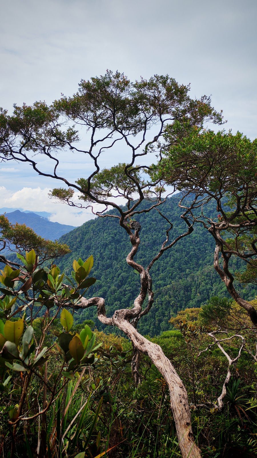
Bukit Padang sits right in the backyard of Kota Kinabalu — a proper urban jungle hill tucked inside Taman Tun Fuad Stephens Park, about 6 km from the city centre. Short, punchy, and rewarding, it punches above its weight when it comes to views. On a clear morning you get KK city, the offshore islands, and if the clouds cooperate, Gunung Kinabalu looming in the distance. Not bad for a hike you can finish before breakfast.

This is a genuine community trail — locals use it for morning exercise, serious hikers use it as Kinabalu prep, and first-timers use it to figure out if hiking is actually for them. The shorter routes are genuinely beginner-friendly; the steeper variants will test your legs. Either way, you're looking at tropical rainforest canopy, concrete stairs, rope sections, and a summit with actual exercise equipment and panoramic views. It's not a wilderness epic — it's a brilliant city hike.
One important heads-up before you plan your trip: Taman Tun Fuad Stephens went through a major RM20 million redevelopment starting in 2022, and some trail sections have been reported as damaged or closed. Trail status can change without much fanfare, so verify conditions before you drive out there. More on that below.
Quick Facts
- Distance: 0.9–2.3 km depending on route; main trail 1.7 km or 2.7 km loop
- Elevation Gain: 114–244 m depending on route; main trail 160 m, or 152–154 m on loop
- Duration: 15–90 minutes depending on route; typical main routes 1–1.5 hours
- Difficulty: Moderate; some routes rated hard; beginner-friendly on shorter routes
- Trailhead: Taman Tun Fuad Stephens Park, Kota Kinabalu — main entrance by Big Lake parking lot; alternate at Kampung Nelayan Seafood restaurant
- Permit: Check with the local park authority for current requirements
- Water on Trail: None — carry your own
- Best Time: Year-round; early morning recommended; avoid rainy days
Getting There & Parking
The park is about 6 km from KK city centre — close enough that some people jog or cycle there. If you're driving, plug in GPS coordinates 5.94739, 116.11543 and it'll get you to the main area. There are two practical starting points: the parking lot next to the Big Lake (main trailhead), or the area by Kampung Nelayan Seafood restaurant (alternate trailhead). Both have parking available. The Big Lake entrance is the more commonly used one and generally easier to navigate if it's your first time here.
Fair warning: Bukit Padang is popular. On weekends and public holidays, parking fills up fast, especially early morning when everyone's chasing the cool air and sunrise views. Get there before 7am if you want a spot without drama. Grab-ing there is also a perfectly reasonable option given how central it is.

Permits & Fees
The facts sheet doesn't specify current permit requirements for Bukit Padang, and with the park having gone through major redevelopment since 2022, the entry situation may have changed. Don't assume it's free or that no registration is needed just because it used to be — park upgrades often come with new access rules.
Trail conditions and permit requirements change — always check with the local forestry office or park authority before you go.
The Trail: What to Expect
There are 12+ distinct trail variants on Bukit Padang. That's not a typo. Different start points, different loops, different difficulty levels — which is why you'll see wildly conflicting distances and times across different apps and websites. The route breakdown below covers the main experience that most hikers follow from the Big Lake trailhead. If you're going with a specific app route, cross-reference with the park signage when you arrive.

Stage 1: Parking Lot Near Big Lake or Kampung Nelayan Restaurant
Start at either the Big Lake parking lot or the Kampung Nelayan restaurant trailhead. Both are legitimate entry points. Get your water sorted here — there are no water sources on the trail, so whatever you start with is what you've got. Mornings are genuinely lovely at this stage; the air is cool, birds are going off, and the shade from the surrounding trees hits different before the sun gets high.
Stage 2: Flat Terrain Through Tropical Rainforest
The first section eases you in with relatively flat terrain through tropical rainforest. Big shade trees overhead, decent cover from the sun. This is where you settle into your pace and get a feel for the trail surface. When it's dry, this section is fine. After rain, it gets slippery fast — the soil doesn't drain instantly and you'll be navigating mud patches. If the trail looks questionable here, it's only going to get worse higher up.
Stage 3: Steep Uphill — Concrete Stairs and Rope-Assisted Sections
Here's where Bukit Padang earns its moderate-to-hard ratings. The trail pitches upward properly, with concrete stairs cut into the slope and rope-assisted sections where the gradient gets serious. Take these sections at your own pace — there's no prize for sprinting up. Grip is everything here. The concrete can be slick when wet, and some trail sections run along stormwater drainage pathways, which means water flows down them during and after rain. If you're wearing flat-soled shoes or worn-out trainers, you'll feel every sketchy step. Good-grip hiking shoes are not optional on this section.

Stage 4: Big Rocks Viewpoint Before the Peak
Before you hit the top, you pass through a section with big rocks that opens up a viewpoint. This is a natural rest stop and worth pausing at — you get a taste of what's coming at the summit without the crowds that sometimes gather there. Catch your breath, drink some water, and enjoy the preview.
Stage 5: Summit — Pyramid Structure and Cross Marker
The summit is marked by a pyramid structure with a cross marker — you won't miss it. This is your photo stop, your achievement moment, your reason for the climb. On a clear day, you get Kota Kinabalu city spread out below, Manukan Island and Sapi Island offshore, and Gunung Kinabalu in the distance. Emphasis on clear day — don't count on Kinabalu if there's any haze or cloud. When it shows up though, it's a serious view.

Stage 6: Wide Hilltop Area With Exercise Equipment and Panoramic Views
Past the summit marker is a wider hilltop area with exercise equipment installed — pull-up bars, that sort of thing. This is popular with the regular morning crowd who treat this as their outdoor gym. It's a social spot, genuinely lively on weekend mornings. Sit down, take in the full 360 of the view, and appreciate the fact that you hiked to a viewpoint that most Sabahans are proud of. One hiker described it as witnessing a sunrise with the majestic Mount Kinabalu in the background — on a clear morning, that tracks completely.
Descent & Safety
Going down Bukit Padang is where most people have problems. The concrete stairs and steeper sections that challenged you on the way up become genuine slip hazards on the descent, especially if conditions have changed while you were at the top. Take your time. Use the ropes on the rope-assisted sections — that's what they're there for.
Real cautions for this trail:
- Slippery and muddy conditions during and after rain. This is the number one hazard. If it starts raining while you're on trail, slow down significantly and test each step. If it's been raining heavily before you go, consider rescheduling — it's not worth a bad fall on a short urban hike.
- Stormwater pathways on trail. Some sections double as drainage channels. Water flows fast down these after rain.
- Trail sections may be damaged or closed. The 2022 redevelopment left some routes in uncertain condition. Verify current status before you go, not after you arrive and find a barrier.
- Monkeys near the rubber plantation area. They're around. Don't feed them, don't approach them, and secure your food and bags.
- Footwear. Loose sandals or flat-soled shoes are a genuine hazard on the steep sections. Proper grip is non-negotiable.
- Insects. Insect repellent is recommended — the rainforest sections have the usual suspects.

Turn back if it starts raining and the trail gets slippery. Bukit Padang will be there next week. A twisted ankle on a 90-minute urban hike is a story you don't want to tell.
What to Bring
Short trail, but don't let that make you lazy about preparation. Here's what actually matters for this hike:
- Water: There are no water sources on trail. At minimum 500ml–1L depending on the weather and your pace. The TAHAN TrailBladder 2L Water Bladder is a solid choice if you like hands-free hydration — keeps water accessible without fussing with a bottle every few minutes on steep sections.
- Hiking shoes with proper grip: Non-negotiable. Wet concrete stairs and muddy trail are not forgiving of bad footwear.
- Trekking pole: Optional for the ascent, but genuinely useful on the steep descent. The TAHAN 3-Section Foldable Hiking Stick V2 folds compact enough to carry in a daypack when you don't need it — worth having along especially if your knees don't love steep concrete stairs.
- Insect repellent: The rainforest sections earn it.
- Light rain jacket or poncho: Quick to pack, saves your day if weather turns.
- Sunscreen: The hilltop is exposed once you're above the canopy.
- Snacks: Optional for a 90-minute hike, but a post-summit snack on the hilltop is a simple pleasure.
- Fully charged phone: For navigation and emergency contact, not just summit selfies.
For a broader breakdown of what gear is worth investing in before you head into Malaysian trails, check out our hiking gear guide — covers poles, knee support, and what's actually worth the spend versus what's marketing.
FAQ
How hard is Bukit Padang?
It depends which route you take. The shorter routes are genuinely beginner-friendly and a lot of locals use this as their regular morning walk. The steeper variants — particularly the longer loop options — are rated moderate to hard, with steep climbs, concrete stairs, and rope-assisted sections. If you're a first-timer, start with a shorter route and see how you go. If you're using it as Kinabalu training, push yourself on the harder variants.
How long does it take to hike Bukit Padang?
Most hikers complete typical main routes in 1–1.5 hours. Shorter routes can be done in 15–30 minutes; if you're doing the full loop at a relaxed pace, allow up to 90 minutes plus time at the top. Add buffer time if you're planning to catch sunrise or spend time at the hilltop viewpoint.
Do I need a permit for Bukit Padang?
The current permit and fee situation isn't confirmed in any source we trust for accuracy, especially given the park's 2022 redevelopment. Don't assume it's free entry. Check with Taman Tun Fuad Stephens Park directly or the Sabah Parks authority before you go for the latest access requirements.
Is Bukit Padang good for training before climbing Gunung Kinabalu?
Yes — it's actually one of its most popular uses. The elevation gain, steep sections, and repeated loop options make it a practical training ground for KK residents prepping for Kinabalu. It won't replicate the altitude or distance, but for building leg strength and getting comfortable with sustained uphill, it does the job well.
Camp Nearby?
Bukit Padang is a day hike — you're not camping on the hill itself. But if you're making a longer trip out of your time in Sabah, there are some solid options worth knowing about. Making a weekend of it? The Tungog Rainforest Eco Camp, Sabah is a proper jungle experience if you want something deeper into the wild. If you're heading toward Kota Belud, check out our reviews of Dingin Batu Campsite, Kota Belud and Nulinau Glamping Garden, Kota Belud — the latter is a good call if you want comfort without sacrificing the outdoor feel. Staying overnight in the Kota Belud area and driving back for an early morning Bukit Padang start is a decent Sabah weekend plan.
Mike has been camping across Malaysia for over 10 years — from jungle treks in Taman Negara to beach camps in Perhentian. He writes about it so you don't have to find out the hard way. Follow along on TAHAN Outdoor's blog for honest campsite reviews, every week.