Bukit Kerinchi: A Hiker's Guide (2026)
Bukit Kerinchi — or Taman Rimba Bukit Kerinchi if you're typing it into Waze — is one of KL's best-kept open secrets. Tucked between Pantai Dalam, Bangsar, and Petaling Jaya, this urban forest gives you actual jungle trails, a cool canopy, wildlife encounters, and a decent little workout, all without leaving the Klang Valley. It's the kind of place city folks rediscover on weekends and keep coming back to.

This is not a serious mountain expedition. The peak sits at around 120–135 m, and most people finish in an hour or two. But don't write it off — the network connects to Bukit Gasing, the trail options range from paved beginner paths to rope-climbing sections and narrow jungle tracks, and if you take the longer routes you're looking at nearly 4 km with close to 300 m of elevation gain. It suits families, solo hikers, dog owners, beginner runners, and anyone who needs green time on a weekday morning. That said, the longer, lesser-marked paths have genuinely confused people — don't do those solo if you don't know the area.
One heads-up before you go: as of July 2025, the suspension bridge — the most photographed attraction in the whole park — is temporarily inaccessible. The rest of the trail network is open and worth it, but if you're coming specifically for that bridge selfie, check current status first.
Quick Facts
- Peak elevation: 120–135 m
- Elevation gain: 104–294 m depending on route chosen
- Distance: 1.2–3.95 km; most common loops 1.6–2.7 km
- Duration: 0.5–3.25 hours; most hikers do it in 1–1.5 hours
- Difficulty: Easy to Moderate; suitable for all fitness levels and ages
- Permit: No permit required for day hiking (free)
- Operating hours: Daily 6:30 am – 7:00 pm
- Toilet fee: RM0.20 at Bukit Kerinchi entrance (Touch 'n Go); Bukit Gasing toilet is free
Getting There & Parking
There are multiple entrances to this forest complex and this is where a lot of people get confused before they even start hiking. The main ones are: Taman Rimba Bukit Kerinchi on the KL/Pantai Dalam side, a Petaling Jaya entrance, and the Pantai Hill Park entrance opposite Saville @ The Park in Bangsar. If you're aiming for the KL side, type Taman Rimba Bukit Kerinchi into Google Maps. If you use Waze without specifying, it'll likely route you to the PJ entrance instead — not wrong, just different.
Parking is free at the official lots at both the Bukit Gasing and Bukit Kerinchi entrances. The catch: spaces fill up fast on weekend mornings. Yellow line enforcement is real, so don't risk it. Honestly, an afternoon start — around 2:30 pm or later — makes a lot of sense here. Cooler weather, fewer crowds, easier parking, and you still have plenty of time before the 7:00 pm closure.

Permits & Fees
Day hiking here is completely free and no permit is required. Just show up, lace up, and go. The only fee you'll encounter is the RM0.20 toilet charge at the Bukit Kerinchi entrance — they accept Touch 'n Go, so keep some e-wallet credit handy. The Bukit Gasing side toilet is free.
If you're thinking about camping here, that's a different story. You'll need a permit from Dewan Bandaraya Kuala Lumpur (DBKL), and it has to be arranged in advance — don't just pitch a tent and hope for the best. There are platforms in the park set aside for camping and picnicking, which is a nice feature for a city forest.
Trail conditions and permit requirements change — always check with the local forestry office or park authority before you go. Or ask the TAHAN Hiking Community on WhatsApp — someone's usually been there that week. Checking a different gunung? Try our free permit checker — instant answer for 90+ Malaysian mountains.
The Trail: What to Expect
Bukit Kerinchi's trail network is a choose-your-own-adventure setup. You can keep it easy on the paved lower sections, or push yourself on the rope climbs and narrow jungle paths. Here's how a typical full loop plays out, hitting the main highlights.
Parking / Entrance
Start at either the Taman Rimba Bukit Kerinchi entrance (KL side) or the Pantai Hill Park entrance in Bangsar. Both are well-signposted. Get your sun protection on before you leave the carpark — the exposed sections get warm fast.

Steel Bridge Crossing (Taman Rimba Entrance)
Entering from the Taman Rimba side, you'll cross a steel bridge early on. It's a clean, pleasant start into the forest. The trail transitions quickly from urban edge to proper tropical canopy.
Paved Paths and Easy Access Sections
The lower sections feature well-maintained paved paths — genuinely beginner and family friendly. This is where you'll see young kids, elderly hikers, and people walking their dogs. Don't let the smooth start fool you though; it changes further in.
Main Trail Split — Choose Your Difficulty
This is the key decision point. The trail network branches here into options of varying difficulty. The shorter, easier loops stay mostly paved or on clear paths. The longer, more challenging routes involve narrower jungle trails that are less clearly marked. If you're on a longer route and you're not with someone who knows the park, stay on the main tracks. A few hikers have genuinely gotten turned around on the lesser-used paths.

Rope Climbing Section
On the more challenging routes, you'll hit a rope climbing section. It's not extreme — most sources describe it as moderate — but it's steep enough to matter, and when it's wet it deserves real respect. Take your time. Going up is always easier than coming back down on a slippery rope line.
'Stairway to Heaven' Section
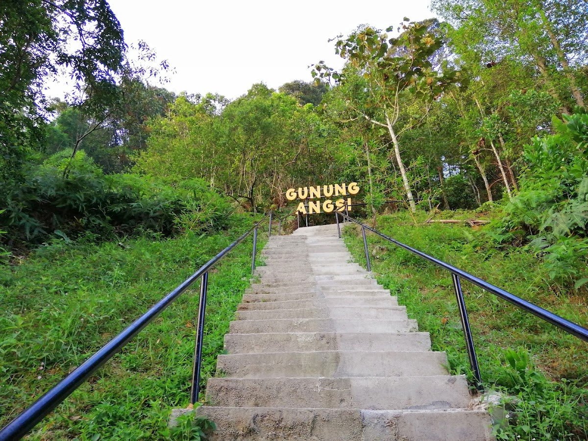
Two small consecutive hills that hikers have nicknamed 'Stairway to Heaven.' Recently upgraded with a new staircase which has made the climb significantly safer, especially when the ground is wet. A genuine improvement to the trail. The views from up here are satisfying for an urban hike.
Bukit Kerinchi Peak & Bukit Gasing Peak (TM Tower)
The Bukit Kerinchi peak and the Bukit Gasing peak with its TM telecommunications tower are both reachable within this network. The peaks themselves aren't dramatic viewpoints, but the forest walk to get there is genuinely enjoyable. There's also a Hindu temple on Bukit Gasing worth a quiet moment if you pass it.

Suspension Bridge
This is the most popular single feature in the park — and as of July 2025, it is temporarily inaccessible. The surrounding trail is still open and worth doing. Check current status before visiting if this is specifically on your list.
Streams, Waterfall, and the Liana Steps Viewpoint
The trail passes small streams and a waterfall where a quick dip or foot soak is possible. Good for cooling down mid-hike. The Liana Steps viewpoint offers some of the better landscape views in the park. Worth lingering if you have time.
Return to Parking
Most loops bring you back to your starting entrance. If you entered from one side and accidentally exited from another — it happens — note that the entrances are not all within walking distance of each other, so keep track of where you parked.
Descent & Safety
The descent on the steeper sections, especially the rope climb and the Stairway to Heaven area, deserves more attention than most people give it. Coming down on wet ground after afternoon rain is where slips happen. Slow down, test each step, and use the rope — that's what it's there for.

Key hazards on this trail:
- Muddy and slippery trails during rainy season — trail conditions change fast after rain
- Wild monkeys — they're present and bold; don't feed them, don't wave food around
- Snakes and wildlife — watch where you step and where you put your hands on roots and rocks
- Mosquitoes — bring repellent, seriously
- Heat and sun exposure — the paved lower sections have less shade; start early or late
- Trail confusion — lesser-used paths are narrower and less clearly marked; stick to main routes if you're unfamiliar
- Stream crossings — check footing before stepping, especially after rain
- Steep rope sections — not dangerous if taken carefully, but don't rush
If weather turns bad while you're in there, turn back. This isn't a remote mountain — you're never far from an exit — but wet jungle trails in urban parks still cause injuries every year. The park closes at 7:00 pm; plan your start time accordingly.
What to Bring
For a 1–1.5 hour urban hike, you don't need to overpack. But a few things really matter here:
- Water — at least 500 ml for a short loop, more for longer routes. The streams are not for drinking.
- Insect repellent — non-negotiable. Mosquitoes are active throughout.
- Grip shoes or trail shoes — the paved sections are fine in sneakers, but the muddy and rope sections need something with actual grip. Not sandals.
- Sun protection — hat, sunscreen, light long sleeves if you're sensitive
- Light rain jacket or poncho — afternoon showers come without much warning in KL
- Touch 'n Go card or e-wallet — for the RM0.20 toilet fee
- Phone charged and offline maps downloaded — particularly if you're exploring the longer routes
If you're taking the steeper routes or have knee concerns, a good trekking pole makes the rope section and descents significantly more manageable. The TAHAN 3-Section Foldable Hiking Stick V2 (RM99) folds compact enough to carry when you don't need it and deploys fast when you do — sensible for an urban trail where you're switching between paved and steep sections. If your knees have opinions on descents, the TAHAN Kinetix Knee Guard with Spring Support (RM79) is worth throwing in your bag for the steeper bits. More on picking the right gear in our hiking gear guide.
FAQ
How hard is Bukit Kerinchi?
Officially rated Easy to Moderate and suitable for all fitness levels and ages. The short loops on paved paths are genuinely easy — good for families and beginners. The longer routes with rope climbs and narrow jungle trails push it into moderate territory. You pick your difficulty based on the route you choose.
How long does it take to hike Bukit Kerinchi?
Most people complete the common loops in 1–1.5 hours. If you go for the longer routes or take your time at the streams and viewpoints, allow up to 3+ hours. The shortest routes can be done in under 30 minutes.
Do I need a permit to hike Bukit Kerinchi?
No permit required for day hiking — it's free and open to all. If you want to camp in the park, you'll need to arrange a permit in advance with DBKL (Kuala Lumpur City Hall). Don't assume you can camp without one.
Can I bring my dog to Bukit Kerinchi?
Yes, Bukit Kerinchi is dog-friendly. Keep your dog leashed, especially around wildlife and other hikers, and clean up after them. Be mindful near the monkey zones — that interaction won't end well for anyone.
Camp Nearby?
Bukit Kerinchi itself has camping platforms if you sort your DBKL permit in advance — a genuinely unusual option for a KL urban forest. If you'd rather base yourself somewhere with proper camping facilities before an early morning start, there are solid options around the Klang Valley worth knowing about. Making a weekend of it? Check out our reviews of Campguru PJ for gear and local knowledge, Cecamping Services, and Woodz Camp Setapak — all within reasonable reach of KL.
Trail conditions, permit updates, and hiking buddies for the weekend — all in one WhatsApp group. Just ask; someone was probably up there last week.
💬 Join the Hiking CommunityFree, one click. No spam — the occasional promo at most.
Mike has been camping across Malaysia for over 10 years — from jungle treks in Taman Negara to beach camps in Perhentian. He writes about it so you don't have to find out the hard way. Follow along on TAHAN Outdoor's blog for honest campsite reviews, every week.