Bukit Desa Damai: A Hiker's Guide (2026)
Bukit Desa Damai sits tucked inside a quiet residential neighbourhood in Bentong, Pahang — and that's exactly what makes it interesting. This is a proper little hill hike, not a manicured park walk. Red dirt trail, rope-assisted steep bits, durian farms on the way up, and if you time it right, a sea of clouds rolling over Bentong at sunrise. For a hill that takes under an hour to summit, it punches well above its weight.

This is a beginner-to-moderate hike that suits families, first-timers, and anyone who wants a short but rewarding outing near Bentong. That said — beginner does not mean easy throughout. There are sections steep enough (~45 degrees) to make your legs work, and the red dirt trail gets slippery when wet. Come prepared, not casual.
One critical heads-up before you plan anything: as of February 2025, the peak has been reported as gated, with public access potentially restricted. This situation may have changed — or not. Do not just show up and hope for the best. Verify access first.
Quick Facts
- Elevation: 417 m above sea level (some sources cite ~323 m; variation exists across records)
- Elevation Gain: 158–242 m depending on source and route taken
- Trail Distance: 1.8–2.9 km one way; sources vary, plan accordingly
- Duration: 20 minutes to 1.5 hours depending on pace; most hikers summit in 30–40 minutes at a steady pace
- Difficulty: Beginner to Moderate — steep sections present, manageable with hiking poles
- Permit Required: No confirmed permit requirement — but verify before visiting (see Permits section)
- Best Time to Go: Early morning, starting at 6:30 AM or earlier for sunrise and laut awan conditions
- Access Status: Potentially gated as of February 2025 — confirm access before going
Getting There & Parking
The trailhead is at Lot 16074, Jalan Desa Damai, Taman Desa Damai, 28700 Bentong, Pahang — about 10 minutes by car from Bentong town. The easiest way to navigate there is to plug Nurjannah Corner (Jalan Desa Damai) into Waze. That gets you close without the usual GPS confusion of residential areas.
Parking is at Nurjannah Corner or the nearby shop lots, then a short walk to the trail entrance. This is a residential neighbourhood — not a carpark. Please do not block driveways, do not park in front of houses, and do not be the reason this place gets fully closed off. Residents here have had issues with hikers being inconsiderate. Don't be that hiker.

Permits & Fees
No permit requirement has been confirmed for Bukit Desa Damai from any reliable source. That said, the trail passes through what appears to be private agricultural land — durian farms, rubber plantations, local farms — and access has reportedly been restricted at the peak as recently as February 2025. The situation is fluid.
Trail conditions and permit requirements change — always check with the local forestry office or park authority before you go. Or ask the TAHAN Hiking Community on WhatsApp — someone's usually been there that week.
The Trail: What to Expect
The trail is short but it is not flat. You are gaining 158–242 m of elevation over a compact distance, which means the trail is steep relative to its length. Here is what the route looks like stage by stage.
Stage 1: Nurjannah Corner to Trail Entrance
Park at Nurjannah Corner and walk toward the Taman Desa Damai residential area entrance. The trail begins at the edge of the neighbourhood — easy to find once you know what you're looking for. Keep an eye out for the trail markers or ask a local if you're unsure. The start is nothing dramatic, just the beginning of a red dirt path heading upward.

Stage 2: Steep Ascent with Rope Sections
This is where the hike earns its moderate tag. The red dirt trail climbs steeply — sections reach around 45 degrees — and you will find ropes fixed at the hardest bits to help you haul yourself up. Use them. This is not the place to be stubborn about using rope assists. On wet days, this section becomes genuinely slippery and the risk of a fall is real. Proper grip shoes are not optional here.

Stage 3: Past the Farms
As the gradient eases slightly, the trail passes alongside durian farms, rubber tree plantations, and vegetable and animal farms. It's a nice reminder that you're hiking through working agricultural land — not a designated recreational forest. Respect the property and stay on the trail. The durian trees alone make this trail feel distinctly Pahang.
Stage 4: Summit
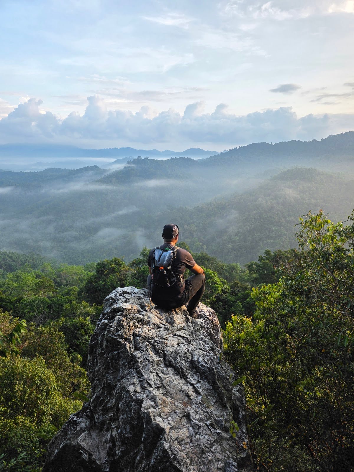
The summit opens up to panoramic views — Kuantan city in the distance, the surrounding residential areas below, and on a clear morning, a glimpse of the South China Sea. If you've started at 6:30 AM and the conditions are right, you may catch the laut awan effect: a sea of clouds filling the valley below the peak. It is genuinely beautiful, and it is the main reason people make the effort to get here early. Recent hikers consistently say the views are worth it — one regular visitor who has come multiple times calls it one of his favourite hiking spots in the area.

Descent & Safety
Going down is where most hiking injuries happen, and Bukit Desa Damai's steep sections make that especially true here. The same rope-assisted stretches you climbed on the way up need to be taken seriously on the descent — face inward, use the ropes, control your steps. Red dirt gets slick fast, especially after morning dew or any rain.
Key hazards to be aware of:
- Steep terrain (~45 degrees): Not negotiable — this requires controlled movement both up and down
- Slippery conditions: Wet red dirt is unpredictable. If it has rained recently, seriously consider postponing
- Rope sections: Present on both ascent and descent — use them, do not skip them
- Residential and private property: The trail borders private farms and homes; stay on marked paths and be respectful
If the weather turns — sudden rain, thick low cloud, visibility drops — turn back. The summit view is the whole point of this hike, and a wet, slippery descent on 45-degree red dirt is not worth it. There will be another morning.

What to Bring
This is a short hike but the steep terrain means your gear choices actually matter:
- Hiking shoes with grip: Mandatory. Trail runners or proper hiking shoes — not sneakers, not sandals. The red dirt will test whatever sole you put on it.
- Hiking poles: The steep sections — especially on descent — are much more manageable with poles. The TAHAN 3-Section Foldable Hiking Stick V2 (RM99) is compact enough to carry in a daypack and folds away when you don't need it. Worth having for those rope sections.
- Water: No confirmed water points on the trail. Bring enough for the full out-and-back — at minimum 1 litre for a short hike like this, more if you run warm.
- Headlamp or lantern: If you're starting at 6:30 AM for sunrise, the trail will be dark at the start. A reliable light is not optional.
- Light rain jacket: Pahang morning weather can shift quickly. A packable jacket takes up no space and matters a lot if cloud rolls in.
- Snacks: Short hike, but you'll want something at the top while you wait for the light.
- Knee support (for descent): If your knees give you trouble on downhills, the TAHAN Kinetix Knee Guard With Spring Support (RM79) is worth throwing in your bag. The descent here is steep enough that knee strain is a legitimate concern on the way down.
Not sure what gear is worth the investment for Malaysian hikes like this? Check out our hiking gear guide for a straightforward breakdown.
FAQ
How hard is Bukit Desa Damai?
Officially rated beginner to moderate, but that beginner label can mislead people. There are sections at roughly 45 degrees with rope assists — that is genuinely steep. If you are a first-time hiker, you will manage it, but go slow, use the ropes, and wear proper shoes. Do not treat this like a flat park walk.
How long does Bukit Desa Damai take?
Most hikers summit in 30–40 minutes at a steady pace. AllTrails estimates 1–1.5 hours for the full out-and-back. If you're moving at a leisurely pace or stopping for photos, allow 1.5 hours total to be comfortable.
Do I need a permit for Bukit Desa Damai?
No permit requirement has been confirmed from any reliable source. However, the peak was reportedly gated as of February 2025, which may indicate changing access conditions. Check the current situation before you go — do not assume it is open just because it was open before.
Is Bukit Desa Damai suitable for beginners and kids?
For fit beginners and older kids who can handle rope-assisted steep sections, yes. For very young children or people with mobility issues, those steep sections are a real barrier. The short distance works in your favour, but the gradient requires honest physical assessment before bringing inexperienced hikers along.
Camp Nearby?
Making a weekend of it? The Bentong–Janda Baik corridor has some genuinely good camping options within easy reach. Camp Mantap, Bentong is the closest and most obvious base — worth reading the review before you book. If you want to extend the weekend into Janda Baik, both Woodstock Camp Janda Baik and Glamping Valley @ Janda Baik are solid options depending on whether you want proper camping or a more comfortable glamping setup. Staying over the night before means you can roll out at 6 AM without the stress of a pre-dawn drive from KL.
Trail conditions, permit updates, and hiking buddies for the weekend — all in one WhatsApp group. Just ask; someone was probably up there last week.
💬 Join the Hiking CommunityFree, one click. No spam — the occasional promo at most.
Gear tip: How to use a trekking pole (and set the height).
Mike has been camping across Malaysia for over 10 years — from jungle treks in Taman Negara to beach camps in Perhentian. He writes about it so you don't have to find out the hard way. Follow along on TAHAN Outdoor's blog for honest campsite reviews, every week.