Bukit Batu Lebah, Melaka: A Hiker's Guide (2026)
Bukit Batu Lebah sits quietly in the interior of Melaka, tucked away in Taman Eko-Rimba Kampung Bukit Senggeh near Selandar. Most Malaysians haven't heard of it — which is honestly part of the appeal. What you get here is a compact limestone hill covered in dense tropical forest, riddled with caves, decorated with wildly shaped rock formations, and home to visible beehives clinging to cliff faces (that's literally where the name comes from — lebah means bee). It's said to be the first cave park in Melaka, and once you're inside, you'll understand why it earned that distinction.

This isn't Gunung Nuang. The elevation sits somewhere in the 500–600 m range and the hike takes most people 4–6 hours depending on which trail combination you take. Difficulty-wise, the terrain itself is moderate-easy — but here's the thing: there are zero directional signs on the trail. None. Hikers have genuinely gotten lost here, and that bumps the navigation difficulty up considerably. Beginners can absolutely do this, but bring a guide. This isn't optional advice — it's the practical reality of this trail.
Who suits Bukit Batu Lebah? Families with some hiking experience, beginner hikers who want more than a flat park walk, cave enthusiasts, birding fans (hornbills have been spotted here), and anyone who wants a proper forest escape without driving three hours from KL. It pairs well with a Melaka road trip — do the caves and summit in the morning, hit Jasin Hot Spring in the afternoon.
Quick Facts
- Elevation: 500–600 m (no single confirmed summit figure)
- Duration: 4–6 hours depending on trail combination (one GPS-recorded loop clocked 4 h 7 min)
- Difficulty: Moderate-easy terrain; navigation difficulty is higher — no trail signage
- Guide required: Yes, for summit hiking, caving, and bird watching
- Permit: Required for summit hiking, caving, and bird watching
- Entry fee: General entry is free (see Permits section for full breakdown)
- Park hours: 07:00–18:00 daily
- Trailhead: Taman Eko-Rimba park entrance, Kampung Bukit Senggeh, 77500 Selandar, Melaka
- Water points on trail: None confirmed — carry your own
Getting There & Parking
The trailhead is at the Taman Eko-Rimba park entrance and ranger station in Kampung Bukit Senggeh, 77500 Selandar, Melaka. GPS coordinates: N2.3987°, E102.4286°. From KL, you're looking at roughly an hour-plus of driving — take the highway past Tol Ayer Keroh and follow the route toward Selandar. The last stretch runs through kampung roads lined with durian and rambutan trees, which is honestly a nice warm-up for the forest ahead.
Register with the rangers at the park entrance before you head out — this is where you'll also arrange your guide. No parking information has been independently confirmed for this guide, so I'd recommend calling ahead on 06-231 6095 (Pejabat Hutan Daerah Melaka, Ayer Keroh office) to confirm the current situation before you drive in.

Permits & Fees
General park entry is listed as free by the official Jabatan Perhutanan page and multiple sources. One third-party listing states RM5 per person — this figure likely applies to permit-required activities (summit hiking, caving, bird watching) rather than general entry. To avoid confusion, just confirm the current fee schedule when you register at the ranger station.
For summit hiking, caving, and bird watching, you need a permit issued by Jabatan Perhutanan Negeri Melaka. Arrange this through the ranger or caretaker at the park entrance.
- Guide fee: RM35 per person (RM40 per person with meal, per reported reviews)
- Overnight camping: RM10 per person per night (capacity 150 people)
- Permit authority: Jabatan Perhutanan Negeri Melaka / Pejabat Hutan Daerah Melaka, Ayer Keroh. Tel: 06-231 6095
Trail conditions and permit requirements change — always check with the local forestry office or park authority before you go. Checking a different gunung? Try our free permit checker — instant answer for 90+ Malaysian mountains. Or ask the TAHAN Hiking Community on WhatsApp — someone's usually been there that week.
The Trail: What to Expect
There are three trails in the park, and sources don't name them clearly — most hikers combine Trail 1 and Trail 3 for a loop that covers the caves and the summit. Your guide will determine the actual route on the day. Here's what you'll encounter along the way.

Park Entrance — Register First
You start at the ranger station. Don't skip the registration — this is how the rangers know who's in the forest. Sort out your permit and guide here. Local guide Amir has been mentioned by name in multiple visitor reviews as a reliable option; the ranger station can connect you. Once that's done, you're heading into a proper lowland tropical forest with the kind of quiet that reminds you why you do this.
Trail 1 — The Cave Circuit
The early section of the trail takes you through the cave network. Five caves are accessible to the public — the remaining roughly 15 are closed due to safety factors, so don't go poking around beyond what your guide shows you.
Gua Kelambu (Mosquito Net Cave) is typically the first cave you'll encounter. From there the trail continues to Gua Reban (Chicken Coop Cave), Gua Tiga Tingkat (Three-Tier Cave), Gua Kura-kura (Turtle Cave), and Gua Batu Senyum (Smiling Cave). Each one has its own character — ancient limestone formations, mysterious interiors, and in several cases, visible beehives at the entrances and on the rock faces outside. Those sarang lebah are part of what makes this place genuinely unusual.
Watch your footing inside the caves. Wet limestone is slippery and cave floors are uneven. Bring a headlamp — not a phone torch, an actual headlamp.

Mid-Hill — Rock Formations and Views
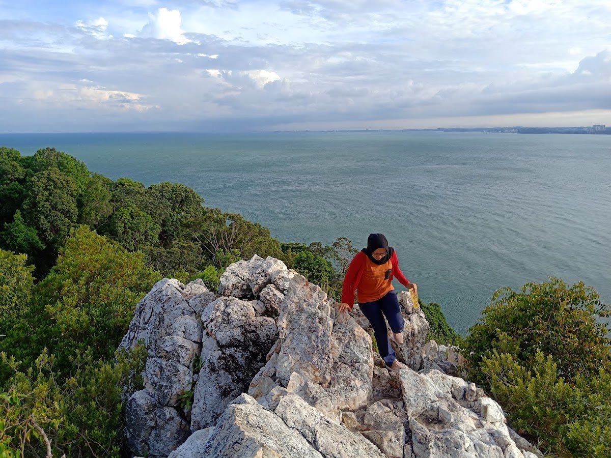
As you gain elevation, you'll start encountering the limestone rock formations that give the hill its character. Look out for Batu Kapal (Ship Rock), Batu Gajah (Elephant Rock), Batu Sendeng, and Batu Tengkolok (Headdress Rock). These aren't labelled — your guide will point them out.
There's a natural rock platform at mid-hill that gives you views over Kampung Bukit Senggeh and the surrounding greenery. Worth pausing here. You'll also pass viewpoints called the Elephant Wall and the Great Wall of Melaka — dramatic names for dramatic rock faces.
Summit — Exposed Rock with Countryside Views
The summit is a large exposed rock at the peak, somewhere in the 500–600 m range. The views look out over unspoiled Melaka countryside — no skyscrapers, no highway noise, just forest and kampung. On a clear morning, it's genuinely rewarding.
The key word is morning. That exposed summit rock heats up fast once the sun climbs. If you started at 7:00–8:00 am like you should have, you'll be up here before the heat becomes punishing.

Descent & Safety
The descent follows your guide's chosen route back. Limestone trails can be slippery on the way down, especially if there's any moisture — go steady, use your trekking pole, and don't rush.
Real cautions for this trail:
- Leeches — reported as numerous by visitors. This is lowland tropical forest. Wear leech socks, tuck your pants in, and don't be surprised. Check yourself thoroughly after.
- Navigation hazard — this is the biggest one. No trail signs exist. People have gotten lost here. Do not hike without a guide.
- Heat exposure — the summit rock is fully exposed. Starting early (7:00–8:00 am) is not just a suggestion; afternoon heat at exposed limestone summits can be serious.
- Unsupervised caves — roughly 15 of the ~20 caves are closed to the public for safety reasons. Stay with your guide and don't explore beyond the sanctioned five.
- Wildlife — bats, twig insects, and hornbills are present. Standard jungle awareness applies.
If the weather turns bad — heavy rain, reduced visibility — don't push for the summit. Wet limestone is a different beast entirely. Turn back, wait it out at the ranger station, and go again another day. The hill isn't going anywhere.
Park closes at 18:00. Give yourself enough buffer to be back at the entrance well before then.
What to Bring

This is a cave-and-summit combo in lowland tropical forest. Pack accordingly:
- Water — there are no confirmed water points on the trail. Carry enough for the full 4–6 hours. A hydration bladder like the TAHAN TrailBladder 2L keeps your hands free, which you'll appreciate on limestone scrambles.
- Headlamp — for the caves. Phone torch won't cut it when you're navigating cave interiors. The TAHAN Luminate Multifunction Lantern doubles as a lantern for your campsite if you're staying overnight.
- Leech socks and insect repellent — non-negotiable here.
- Trekking pole — limestone descents are where trekking poles earn their keep. See our hiking gear guide if you're not sure what to look for.
- Snacks and energy food — 4–6 hours is a solid outing. Pack real fuel.
- Covered shoes or hiking boots — trail runners at minimum. No sandals.
- Light rain jacket — tropical weather doesn't announce itself.
- Cash — for guide fees and any permit charges. No card machines at ranger stations.
- Emergency contact info — leave your itinerary with someone who isn't hiking with you.
FAQ
How hard is the Bukit Batu Lebah hike?
The terrain itself is moderate-easy — this isn't a death march. But the absence of any trail signage makes navigation genuinely tricky, and hikers have gotten lost here. Fitness-wise, most reasonably active people will manage fine. Navigation-wise, you need a guide. With one, beginners can do this comfortably.
How long does the Bukit Batu Lebah hike take?
Most sources put it at 4–6 hours depending on which trail combination you take. One GPS-recorded loop came in at 4 hours 7 minutes. Add time for cave stops, photography, and summit rest — budget a full half-day.
Do I need a permit for Bukit Batu Lebah?
Yes, if you're doing the summit, caving, or bird watching — all three require a permit from Jabatan Perhutanan Negeri Melaka. General entry to the park is free. Permits are arranged through the ranger station at the park entrance. Call 06-231 6095 to confirm current requirements before you go.
Is a guide compulsory at Bukit Batu Lebah?
Yes. Guides are required for summit hiking, caving, and bird watching — and honestly, given that there are zero trail signs and people have genuinely lost their way here, this rule makes complete sense. Guide fees run RM35 per person (RM40 with a meal). Arrange one at the ranger station, or ask about local guide Amir who gets good mentions in visitor reviews.
Camp Nearby?
Making a weekend of it? Bukit Batu Lebah is a solid morning activity, and Melaka has decent options if you want to stay over the night before for an early start. Check out The Coco Journey Glamping, Melaka for something a bit more comfortable, Campsite Ayong Deen, Melaka if you prefer a more traditional campsite setup, or Beach N Breeze Glamping, Melaka for a coastal wind-down after the hike. The park itself allows overnight camping at RM10 per person per night (capacity 150) — worth considering if you want to do the nocturnal walk that the park offers as an arranged activity.
Trail conditions, permit updates, and hiking buddies for the weekend — all in one WhatsApp group. Just ask; someone was probably up there last week.
💬 Join the Hiking CommunityFree, one click. No spam — the occasional promo at most.
Gear tip: How to use a trekking pole (and set the height).
Mike has been camping across Malaysia for over 10 years — from jungle treks in Taman Negara to beach camps in Perhentian. He writes about it so you don't have to find out the hard way. Follow along on TAHAN Outdoor's blog for honest campsite reviews, every week.