Bukit Bangkong, Chemor: A Hiker's Guide (2026)
Bukit Bangkong isn't trying to be Gunung Kinabalu. It's a community hill in Chemor, about 20 km north of Ipoh, and it knows exactly what it is — a genuinely enjoyable short hike with a summit view that punches well above its 312 m elevation. Standing up top, you're looking straight at Gunung Korbu (2,181 m) and Gunung Yong Yap, the sixth-highest peak in West Malaysia, plus the whole sweep of the north Kinta Valley laid out below. Not bad for a morning's work.

This one suits beginners, families with older kids, and anyone easing back into hiking after a long break. The trail is well-marked, community-managed, and maintained well enough that most of it is concrete or tarmac. There's a small patch of red earth near the top that gets proper slippery when wet, so don't dismiss it entirely — but on a clear morning, Bukit Bangkong is as friendly a hill as you'll find in Perak.
It also works brilliantly as a warm-up hike if you're building towards bigger objectives. Tick this off before brunch, and you've still got the whole day ahead of you.
Quick Facts
- Summit Elevation: 312 m
- Elevation Gain: Around 225 m (some route variants report slightly more or less)
- Distance: 2.1 mi (approx. 3.4 km) out-and-back on the primary route; a 4.5 km loop variant exists
- Duration: Most hikers report 1.5–2 hours; fast walkers have done it in 30–40 minutes
- Difficulty: Moderate (AllTrails primary); many locals rate it Easy — expect a mix depending on your fitness level
- Permit Required: No — free of charge, no registration needed
- Guide Required: No
- Best Time: Year-round; mornings are ideal
- Parking: Approximately 20 car spaces at trailhead
- Pet-Friendly / Kid-Friendly: Yes
Getting There & Parking
The trailhead is at the end of the road through Tanah Hitam village in Chemor, roughly 20 km north of Ipoh city centre. You'll know you've arrived when you see the iconic dragon sculpture — hard to miss, and a good landmark to search for when navigating. Chemor itself is easy to reach via the North-South Expressway; plug "Bukit Bangkong Chemor" into Waze and it'll take you there without drama.
Parking is limited to around 20 car spaces right at the trailhead. On weekend mornings especially, these fill up fast — locals who hike here regularly will tell you to arrive before 7:30 am if you want a spot without circling. There are also toilet facilities at the trailhead, which is a bonus you don't always get on Malaysian community hills.

Permits & Fees
No permit, no registration fee, no forest department check-in. Bukit Bangkong is community-managed and completely free. You show up, you hike. That said, community-managed doesn't mean unregulated — please don't litter, don't play loud music on the trail, and leave the place the way you found it. The community maintains this hill and it shows.
Trail conditions and permit requirements change — always check with the local forestry office or park authority before you go. Or ask the TAHAN Hiking Community on WhatsApp — someone's usually been there that week. Checking a different gunung? Try our free permit checker — instant answer for 90+ Malaysian mountains.
The Trail: What to Expect
The route is well-marked with clear signage throughout. Most of the surface is concrete or tarmac, with sections of pebbled path, and one short stretch of red earth near the top. Multiple rest shelters are dotted along the way, so even beginners can go at their own pace without feeling stranded.

Stage 1: Trailhead — Dragon Sculpture & Temple
You start right where the road ends, next to the dragon sculpture. Just a short distance in, you'll pass a temple. It's a striking start to a hike — part trail entrance, part cultural landmark. Take a moment, look around, then head up.
Stage 2: The 45-Degree Tarmac Slope
Don't be lulled by the flat start. The tarmac road kicks up at a steep 45-degree slope fairly early on. It's short, but it gets the legs burning. On a hot morning this section earns respect. Take it steady, especially if you're bringing kids or haven't hiked in a while. Going too fast here means you pay for it later.

Stage 3: Pebbled Path Section
After the tarmac assault, the path transitions to a pebbled surface. The gradient eases off a bit here. This is where the trail feels most like a proper jungle walk — shade from the trees on either side, good footing on dry days. In wet conditions, even the pebbled section needs a bit of care.
Stage 4: Korbu View Junction
You'll hit a junction where a right turn takes you on an alternate route. This is your first proper reward — from around this point you start getting glimpses of Gunung Korbu rising up in the distance. If you want the loop variant rather than out-and-back, this is where that decision gets made. Both routes lead to the summit; the loop adds distance but gives you different scenery on the way down.
Stage 5: Concrete Stairs
The last push before the summit involves concrete stairs. One reviewer put it honestly: the final 200 m or so is the steepest section of the whole climb. It's still manageable — take it slow, use the handrails if they're there, don't rush. Wet stairs are not your friend.

Stage 6: The Peak — Gazebo & Views
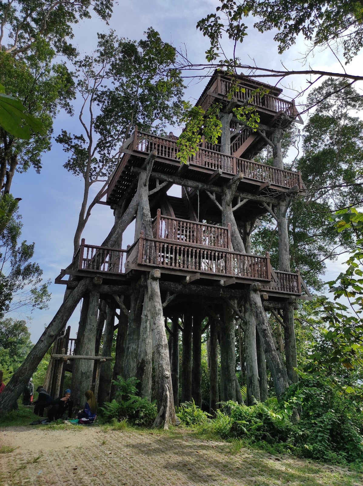
The summit area is surprisingly spacious — a large open peak with shade trees and a gazebo big enough to shelter well over 100 people. On a clear morning, the view of Gunung Korbu and Gunung Yong Yap is genuinely impressive. The north Kinta Valley, Chemor, and Jelapang stretch out below. This is a proper sit-down-and-eat-your-nasi-lemak-bungkus moment. Enjoy it.

Descent & Safety
Coming down Bukit Bangkong is where people get caught out. The concrete stairs and tarmac slope that felt straightforward on the way up become significantly more treacherous when wet. The small red earth section near the top — reviewers describe it as "slippery during wet seasons, extremely" — is not exaggerating. One wrong step on wet red earth and you're sliding.
Real cautions for this trail:
- Rain makes this trail dangerous. The short red earth section near the summit becomes very slippery. The concrete stairs and tarmac slope are also hazardous when wet. Wear shoes with proper grip — trail shoes, not sandals, not kasut sukan biasa.
- Descend slowly on the stairs. Momentum going downhill plus steep concrete is a bad combination.
- Check the weather before you go. If it's been raining or rain is forecast, consider rescheduling or at minimum go prepared with trekking poles for extra stability.
- Morning starts are smart. Not because of extreme heat at 312 m, but afternoon thunderstorms are common in Perak — getting caught on a wet trail on the way down isn't fun.
- Kids and older hikers: The trail is generally suitable, but supervise closely on the steep sections and stairs, wet or dry.
There are no recorded water points on this trail in the sources I have — bring your own water and don't rely on finding any along the route.
What to Bring
Bukit Bangkong is a short hike, but short doesn't mean you leave the basics at home. Here's what makes sense for this trail:
- Water: At least 500 ml to 1 litre per person. No water sources on trail. A hydration bladder keeps it hands-free.
- Proper footwear: Trail shoes or hiking shoes with good grip. This is non-negotiable if there's any chance of rain.
- Trekking poles: Optional on a dry day, genuinely useful on a wet one. The steep tarmac slope and concrete stairs are where poles earn their keep on the descent. The TAHAN 3-Section Foldable Hiking Stick V2 folds down small enough to clip onto a day bag when you don't need it — worth having in your car boot for exactly this kind of hike.
- Sun protection: Hat, sunscreen. The summit gazebo has shade but the trail itself has exposed sections.
- Light snack: It's a short hike but the summit view deserves a proper rest stop. Pack something.
- Rain jacket or poncho: Perak weather can change fast. A packable layer takes up almost no space.
- Knee support: If your knees give you grief on descents — and the concrete stairs here are steep — the TAHAN Kinetix Knee Guard With Spring Support is worth strapping on before you start. Better to wear it and not need it than the reverse.
For a fuller breakdown of poles versus knee guards and when to use each, check out our hiking gear guide.
FAQ
How hard is Bukit Bangkong?
Depends who you ask. AllTrails rates it Moderate; plenty of locals will tell you it's Easy. The honest answer: the trail is short, well-maintained, and suitable for beginners and families. But the 45-degree tarmac slope near the start and the steep concrete stairs near the summit are real — not brutal, but not flat either. Call it an easy-moderate hike that's harder when wet.
How long does Bukit Bangkong take?
Fast hikers doing it as exercise have reached the summit in 30–40 minutes. Most people report the full out-and-back (including time at the top) taking 1.5–2 hours. If you're going with kids or taking it slow to enjoy the views, budget 2 hours comfortably.
Do I need a permit for Bukit Bangkong?
No permit and no fee. The hill is community-managed. Just show up at the trailhead in Tanah Hitam village, Chemor. No registration, no check-in required.
Is Bukit Bangkong suitable for kids and beginners?
Yes — it's one of the more beginner-friendly hills in Perak. The trail is short, well-marked, and has multiple rest shelters. Kids should be supervised on the steeper sections and stairs. On a dry day, most reasonably fit beginners will be fine. Avoid bringing very young children on wet days when the trail gets slippery.
Camp Nearby?
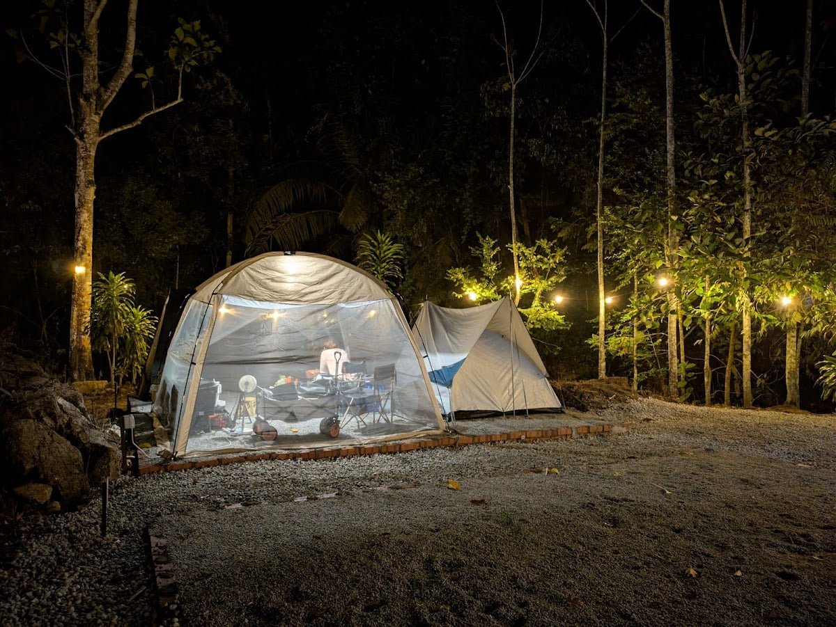
Making a weekend of it? Bukit Bangkong is a morning hike — you'll be done before lunch. Pair it with a night under the stars at one of these spots nearby in Perak. Seven Beret Campsite, Batu Kurau is a solid option north of Ipoh if you want to camp the night before and start fresh. To the south, The Hideout Gopeng is a popular pick with good facilities and a bit of a jungle feel. If you want something a bit different, WildRock Campsite Padang Rengas is worth checking out. All three are within reasonable striking distance of Chemor — plan the drive the night before so you're not scrambling on the morning of your hike.
Trail conditions, permit updates, and hiking buddies for the weekend — all in one WhatsApp group. Just ask; someone was probably up there last week.
💬 Join the Hiking CommunityFree, one click. No spam — the occasional promo at most.
Gear tip: Water bladder or bottle on a humid trail.
Mike has been camping across Malaysia for over 10 years — from jungle treks in Taman Negara to beach camps in Perhentian. He writes about it so you don't have to find out the hard way. Follow along on TAHAN Outdoor's blog for honest campsite reviews, every week.