Bukit Bakar, Kelantan: A Hiker's Guide (2026)
Bukit Bakar sits inside Hutan Simpanan Kekal Ulu Sat, about 63 km from Kota Bharu, and it's one of those hills that means different things to different people. Come from Machang, and you're signing up for a proper climb — steep, sweaty, muddy when wet, with forest views that reward the effort. Come from Jeli, and you're getting a short recreational walk that's done before lunch. Same hill, very different days out. Know which one you're planning before you go, because the two routes are not interchangeable.

The Machang route draws hikers who want a genuine workout in Kelantan's interior — the elevation gain, the dense jungle canopy, the waterfall at the end. The Jeli route suits families, casual walkers, or anyone who just wants to spend time in the forest without committing their legs for the rest of the week. Bukit Bakar as a recreation forest also has a proper setup — food stalls, rest shelters, bathing pools, a suspension bridge — so this isn't a remote wilderness experience. It's accessible, which is exactly the point for a lot of people.
This guide covers both routes honestly. If you're coming for the Machang climb, treat it seriously. If you're coming for the Jeli walk, bring the kids and enjoy it for what it is.
Quick Facts
- Location: Hutan Simpanan Kekal Ulu Sat (Ulu Sat Forest Reserve), Kelantan
- Machang Route Distance: 4.6–5.37 mi (7.4–8.6 km) out-and-back
- Jeli Route Distance: 1 mi (1.6 km) out-and-back
- Summit Elevation: Approximately 616 m (conflicting sources also report 585 m — likely survey differences)
- Machang Route Elevation Gain: 1,820 ft (555 m)
- Jeli Route Elevation Gain: 426 ft (130 m)
- Machang Route Duration: 3–4 hours
- Jeli Route Duration: 30 minutes to 1 hour
- Difficulty — Machang: Hard/Difficult
- Difficulty — Jeli: Moderate
- Permit: Entrance fee status unclear — check before you go. Overnight camping requires written permission from Pengarah Perhutanan Negeri Kelantan.
- Operating Hours: Historically listed as 7:00 AM–7:00 PM (from 2012 records — may be outdated; verify locally)
Getting There & Parking
The Machang trailhead is 7 km from Machang town centre, which itself is roughly 63 km from Kota Bharu. Roads are generally well-maintained and the route is well signposted from Machang town — if you can find your way to Machang, finding the trailhead isn't difficult. Most people coming from KB will drive; public transport options to the trailhead are limited, so plan for your own wheels or arrange a ride.
The Jeli trailhead is located in Jeli, Kelantan. Specific distances from Jeli town centre aren't confirmed in any source I've seen, so if you're navigating there for the first time, get the coordinates from AllTrails or call ahead to the forestry office for directions.
Parking is available near the entrance with ample space, even on busier weekends. No overnight parking specifics are documented — if you're planning an early start or an overnight stay, confirm arrangements with the forestry department.

Permits & Fees
This is where things get murky. Sources from 2012 report no entrance fee. The current AllTrails listing flags that a fee may be charged. Given more than a decade has passed, it's very possible the fee structure has changed. Don't assume it's free.
For day hiking, bring some cash just in case there's an entrance fee at the gate. For overnight camping or stays within the forest reserve, you'll need written permission from the Pengarah Perhutanan Negeri Kelantan (Kelantan State Forestry Director) — this is managed by Jabatan Perhutanan Negeri Kelantan. Don't show up hoping to wing it for an overnight; get the written permission sorted in advance.
Trail conditions and permit requirements change — always check with the local forestry office or park authority before you go.
The Trail: What to Expect
There are two separate trails here. The sections below cover the Machang route as the primary hiking route, with a note on the Jeli option at the end.
Trailhead & Recreation Forest Entrance
Both routes start from their respective trailheads within the Ulu Sat Forest Reserve. The Machang entrance comes with proper recreation forest infrastructure — food stalls (reportedly decent and reasonably priced), rest shelters, public toilets, a suspension bridge, a playground, and a climbing stairs section up to a cliff face. Use the toilet before you start. Buy your food or drinks while you can. The trail itself doesn't have confirmed water points beyond the river and pools near the entrance.

Herb Tree Trail Section & Waterfall Approach
Early on the Machang route, you'll pass through a section planted with herb trees — it's a deliberate feature of this recreation forest, not just random jungle. The trail heads toward a waterfall, which is one of the main draws of this hike. The terrain here is still manageable, but pay attention to the ground conditions. If it's rained recently, mud starts here and doesn't stop.
The waterfall at the trail end is the highlight for many people — worth the climb if conditions are good. Just be realistic: if the water level is high from recent rain, the area around it can be less inviting and potentially risky to approach.

Main Climbing Section
This is where the Machang route earns its Hard/Difficult rating. The climb is steep — 555 m of elevation gain over a relatively short horizontal distance. The trail gets aggressive quickly. In dry conditions, it's a demanding but manageable climb for fit hikers. In wet conditions, it becomes a mud slide and a genuine hazard. Insects are present throughout; don't skip the repellent.
Take your time on this section. There's no prize for speed, and rushing on steep muddy terrain is how people get hurt. Trekking poles make a real difference here — I'd rate the TAHAN 3-Section Foldable Hiking Stick V2 as good value for exactly this kind of gradient. Compact when you don't need it, solid when you do.

Summit at Bukit Bakar Peak
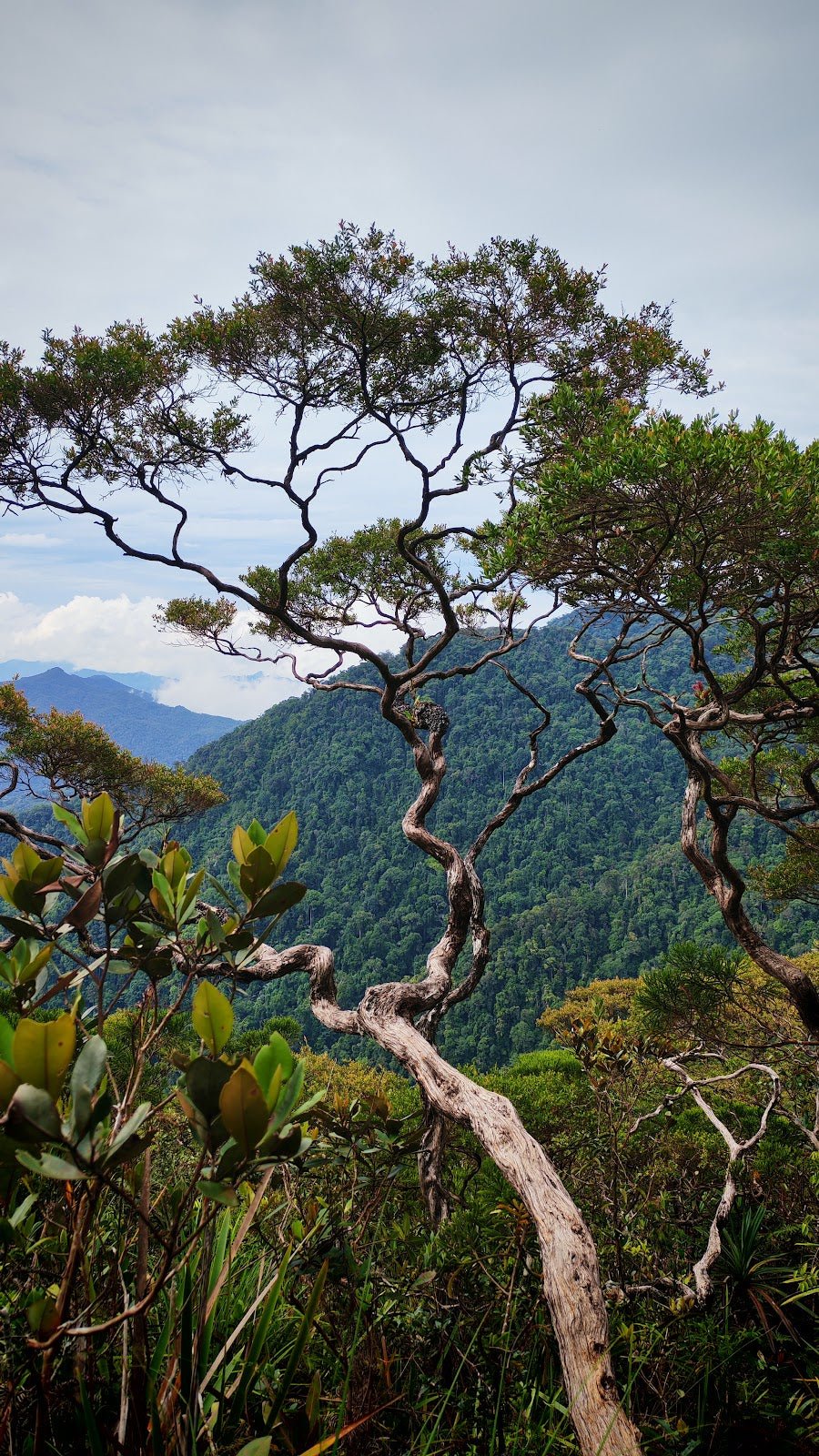
The summit sits at approximately 616 m — though some sources report 585 m, likely a survey discrepancy or difference between multiple high points. Either way, you'll know when you've hit the top. On clear days, the views of the surrounding hills are genuinely worth it. There's also a weather-dependent phenomenon locals describe as a "cloud carpet" — essentially low cloud rolling through the valleys below. If you catch it, great. If not, the forest views still hold up.
Rest here, eat something, take your photos. Then prepare for the descent, which on this route is the part where most mistakes happen.
Jeli Route Option
If you're taking the Jeli route, the whole out-and-back is 1.6 km with 130 m of elevation gain, done in 30 minutes to an hour. It's rated Moderate. Good for families, older hikers, or anyone who wants to experience the forest without the full climb. Don't underestimate it in wet conditions — "Moderate" still means forest trail, not a paved path — but it's a very different commitment from the Machang route.
Descent & Safety
On the Machang route, the descent is where legs and knees take the real punishment. Steep ground coming down on tired muscles, potentially muddy underfoot — this combination causes the majority of trail incidents. Slow down. Use your poles. If your knees are a known weakness, consider a knee support; the TAHAN Kinetix Knee Guard With Spring Support is worth packing for descents like this one.

Key hazards on this trail:
- Mud and slip risk: High after any rainfall. The main climbing section becomes dangerous when wet — this is not an exaggeration.
- Elevated water currents: Hiking is not recommended immediately after rain, especially near water features. River and pool levels rise quickly.
- Insects: Present throughout. Bring proper repellent, not just a small bottle.
- Wet footing: Even in dry weather, shaded forest sections stay damp. Watch your step on roots and rocks.
If the weather turns while you're on the trail — especially if rain starts during the climb — turn back. The mud risk on the descent after fresh rain is serious. Check the sky before you start, and if it's already been raining, consider postponing. This is not a hill where you want to test your luck on slippery ground.
The operating hours on record are 7:00 AM to 7:00 PM, though this data is from 2012. Start early regardless — it gives you time to summit and descend comfortably before conditions change, and before the afternoon heat and potential rain build up.
What to Bring
- Trekking poles: Non-negotiable for the Machang route. The steep descent alone justifies them. The TAHAN 3-Section Foldable Hiking Stick V2 folds down small enough for your bag when you don't need it on flatter sections.
- Knee support: If you have any history of knee issues, the descent on Machang will remind you. The TAHAN Kinetix Knee Guard With Spring Support is a small addition with a big payoff.
- Water: Bring enough for the full duration — 3–4 hours on Machang minimum. Water availability on the trail itself is not confirmed; don't rely on finding a stream when you're thirsty.
- Insect repellent: Not optional. Bring a full-sized bottle.
- Grip boots: Trail shoes or boots with proper lug soles. Sneakers are a bad idea on the muddy climb.
- Rain jacket or poncho: Weather in Kelantan can move fast. Light and packable.
- Food and snacks: Food stalls are at the entrance, not on the trail. Eat before you climb, and carry enough for the route.
- Cash: For the potential entrance fee and food stalls at the entrance.
- First aid basics: Plasters, antiseptic, any personal medication.
For a fuller breakdown of what to bring on a Malaysian hill hike, check out our hiking gear guide — covers poles, knee guards, and what actually matters on local trails.
FAQ
How hard is Bukit Bakar?
Depends entirely on which route. The Machang route is rated Hard/Difficult — 555 m of elevation gain in a relatively short distance, with steep, muddy terrain that gets genuinely dangerous in wet conditions. Fit, experienced hikers will find it challenging but manageable in dry weather. Beginners should think carefully. The Jeli route, on the other hand, is rated Moderate — 130 m of elevation gain, done in under an hour. Very different hikes.
How long does Bukit Bakar take to hike?
Machang route: most hikers report 3–4 hours for the full out-and-back. Factor in time at the waterfall or summit, and add buffer if you're not moving fast on steep terrain. Jeli route: 30 minutes to 1 hour. Both are out-and-back, so what takes you up will take you back down.
Do I need a permit for Bukit Bakar?
For a day hike, there may be an entrance fee — the current status is unclear, as older sources say free but more recent listings suggest a fee is charged. Bring cash to be safe. For overnight stays or camping within the forest reserve, written permission from the Pengarah Perhutanan Negeri Kelantan is required. Contact Jabatan Perhutanan Negeri Kelantan before any overnight trip.
Is Bukit Bakar suitable for families?
The Jeli route is. Short, moderate, and accessible for kids who are comfortable on forest trails. The recreation forest facilities at the Machang entrance — bathing pools for children, playground, food stalls, rest shelters — also make it a good day out for families who aren't going all the way to the summit. The Machang summit route is not suitable for young children or anyone not comfortable with steep, potentially muddy hiking.
Camp Nearby?
Making a weekend of it? Kelantan has some decent options for extending your trip. Campsite Kenerong 108 is worth checking out if you want to stay in the region. For something completely different after your Bukit Bakar day, Juita Glamping Perhentian is a solid option if you're willing to head to the coast — good way to reward yourself after the climb. And if you're looking for something with a bit more structure, Lata Hujan Training Centre, Tanah Merah is close enough to be a practical base. An overnight stay nearby lets you start the Machang route early and beat the heat.
Mike has been camping across Malaysia for over 10 years — from jungle treks in Taman Negara to beach camps in Perhentian. He writes about it so you don't have to find out the hard way. Follow along on TAHAN Outdoor's blog for honest campsite reviews, every week.