Gunung Penrissen: A Hiker's Guide (2026)
Gunung Penrissen sits on the border between Sarawak and Kalimantan, and it carries a kind of weight that you don't find on many peaks. At 1,326m, it's not the tallest mountain in Sarawak, but what it asks of you physically — and the views it gives back — put it in a different class from your average weekend hill. This is a serious jungle mountain with a serious personality.
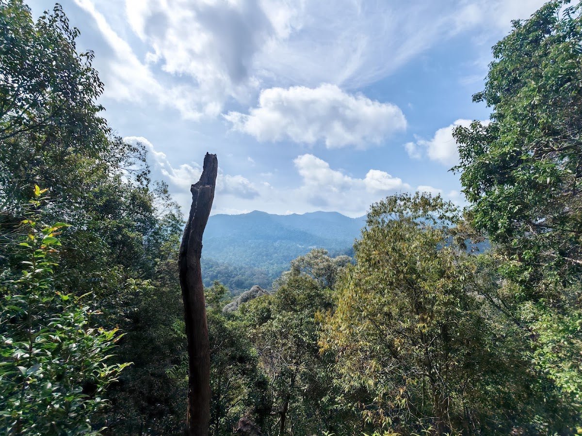
People come here for two reasons: the raw Bornean jungle, and the views that drop straight into Indonesia. On a clear day you can pick out the triangular cone of Gunung Merdai rising out of Kalimantan. Local hikers consider it sacred ground, and honestly, when you're standing on the ridge looking across the border, you understand why. One regular describes it simply as his favourite "sacred" mountain — and that tracks.
This hike is rated Difficult, and that rating is earned. There are near-vertical sections, steel ladders with serious exposure, loose rock underfoot, and sections of trail that aren't clearly marked. If you're building up your hiking CV in Sarawak, this is not your starter peak. But if you're ready for it, Penrissen is something special.
Quick Facts
- Summit elevation: 1,326m
- Distance: 9.7–10.5 km round trip
- Elevation gain: 610–656m
- Duration: 6–6.75 hours for a day hike; 2–3 days for overnight trek
- Difficulty: Difficult — steep ascent with near-vertical sections and steel ladders; not recommended for inexperienced hikers or those afraid of heights
- Permit required: No
- Guide required: Not mandatory, but strongly advised unless you're hiking with experienced friends
Getting There & Parking
The most common access point is Borneo Highlands Resort in Padawan, about 2 hours by car from Kuching. The address is Jalan Borneo Heights, Padawan. You can also start from Kampung Annah Rais, which gives you a different approach — guides are available from the village too.
Most hikers start from either the resort clubhouse at 835m elevation (the higher and easier starting point) or the carpark at 730m. The main resort entrance is 7–8 km from the carpark, so factor that in. If you're not driving yourself all the way up, transport from the main entrance to the carpark costs RM10 and involves a further 30-minute walk to the clubhouse. Return transport from the main entrance is RM50. Sort out your logistics the night before — you don't want to be figuring this out at the trailhead at 6am.
Permits & Fees
No permit is required to climb Gunung Penrissen. That said, if you're going through Borneo Highlands Resort — which many hikers do — their guided day-hike package was priced at RM260 per person as of 2018, which includes a simple lunch. That figure is a few years old now, so confirm the current rate directly. Contact: dianne@borneohighlands.com.my. Book at least one week in advance — they're not running a walk-in operation.
If you prefer to hire a guide independently, you can do so at Kampung Annah Rais. Again, book ahead rather than hoping someone's free on the day.
Trail conditions and permit requirements change — always check with the local forestry office or park authority before you go.
The Trail: What to Expect
The trail breaks into distinct phases. The early section is manageable jungle hiking; the second half is where Penrissen shows its teeth. Read this before you go.
Stage 1: Clubhouse / Carpark Start (730–835m)
You begin at either the carpark (730m) or the clubhouse (835m). If you start from the carpark, add 30 minutes and some elevation to your morning. The trail here is dense jungle — machete-cut paths through proper Bornean rainforest. The flora and fauna are genuinely unique to Borneo, so take a moment to notice your surroundings before the hard work starts. There are streams near the start of the hike if you need to top up water, but bring approximately 2 litres of water from the start regardless.
Stage 2: Approach to the Malaysia-Indonesia Border (approximately 1 hour from start)
About an hour in, you hit the national boundary between Malaysia and Indonesia, marked with a wooden fence. This is a solid milestone and a good place to check yourself — energy levels, water, time. The terrain up to this point gives you a preview of what's ahead. If anything feels off, this is a sensible turnaround point before the trail gets serious.
Stage 3: Steep Jungle-Clad Cliffs and Rocky Terrain
Past the border marker, the character of the trail changes sharply. The path becomes steeper, rockier, and less clearly defined. Ground underfoot is occasionally unstable — watch out for hidden gaps and deep holes between rocks. Route-finding requires more attention here; the trail isn't always obvious. If you're without a guide, slow down and be methodical. Rushing through unmarked jungle terrain is how people get into trouble.
Stage 4: Near-Vertical Ascent and Steel Ladders
This is the section that earns Penrissen its Difficult rating. The ascent goes near-vertical in places, with crude steps cut into the slope — some of them loose. Steel ladders have been installed to help with the most exposed climbing, but some of those ladder sections involve drops of a couple hundred metres if you slip. This is not an exaggeration for dramatic effect. If you have vertigo or a genuine fear of heights, turn back here. There is no shame in it — this exposure is real and sustained. A ladder damage incident was reported in June 2018, and while things may have been repaired since, always inspect ladders before committing your weight. Check current conditions before your trip.
Stage 5: Summit (1,326m)
When you get there, you get it. Views down into Indonesia and across rolling Kalimantan rainforest — including Gunung Merdai on a clear day — make everything that came before worthwhile. This is unspoiled Borneo at elevation. Take your time at the top, eat something, and start thinking about the descent before your legs forget what they need to do.
Descent & Safety
Coming down Penrissen is not a relaxed stroll. The near-vertical sections and loose steps that challenged you on the way up are just as demanding in reverse — arguably more so, because tired legs on loose rock going downhill is where most hiking accidents happen. Take the ladder sections slowly and deliberately, always maintain three points of contact, and don't rush because you want to beat the dark.
Key hazards summary:
- Extremely steep ascent and near-vertical terrain in upper sections
- Steel ladders with significant exposure — not suitable for those with fear of heights or vertigo
- Crude, loose steps in the early steep section
- Rocky, unstable terrain with deep holes between rocks
- Poorly marked trail in the second half — easy to lose the path
- Potential for rockfall and landslides (documented in 2018; current conditions unknown)
- Steep jungle cliffs requiring careful, deliberate navigation
If weather turns bad — rain, mist, reduced visibility — turn around without negotiating with yourself. Wet rock on a near-vertical slope with a couple hundred metres of exposure is a completely different proposition from the same trail on a dry morning. The mountain will still be there next time.
What to Bring
This hike demands more than a half-litre of mineral water and a snack. Pack properly.
- Water: Minimum 2 litres. Streams exist near the start but don't rely on them past that point
- Trekking poles: Genuinely useful on the steep lower sections and critical on descent. A reliable TAHAN 3-Section Foldable Hiking Stick V2 (RM99) packs small and gives you real stability when the ground gets loose underfoot
- Knee protection: After 600+ metres of descent on rocky trail, your knees will know about it. The TAHAN Kinetix Knee Guard with Spring Support (RM79) is worth bringing if you've had any knee issues before
- Gloves: You'll be grabbing ladder rungs and rocky handholds. Thin grip gloves protect your hands without killing your feel
- Sturdy hiking boots: Trail runners won't cut it here. You want ankle support and a sole with real grip on wet rock
- Headlamp with spare batteries: Even on a day hike — if you're slower than expected on descent, you don't want to be fumbling around on those ladders in the dark
- Rain jacket: Sarawak weather does what it wants. Pack one
- Food and snacks: High-calorie, easy to eat. The resort package includes lunch; if you're self-guided, bring your own
- First aid basics: Plasters, antiseptic, knee wrap
- Fully charged phone: For navigation and emergency contact — and let someone know where you're going before you leave
For a fuller breakdown of what to pack for tough Malaysian hikes, check out our hiking gear guide.
FAQ
How hard is Gunung Penrissen?
It's rated Difficult and that rating is accurate. Expect near-vertical climbing, steel ladders with real exposure, loose and unstable ground, and sections of trail that aren't clearly marked. This is not a hike for beginners or anyone who struggles with heights. If you've done a handful of easier hills and feel confident, come with a guide for your first time. If you're experienced and comfortable with exposure, you'll manage — but respect the terrain.
How long does it take to hike Gunung Penrissen?
Most hikers report 6–6.75 hours for the day hike round trip. There's also a 2–3 day overnight trek option for those who want to move slower and take it in properly. Your actual time will depend on fitness, pace, how long you spend at the summit, and conditions on the day.
Do I need a permit to climb Gunung Penrissen?
No permit is required. If you go through Borneo Highlands Resort, their guided package has its own fee (RM260 per person as of 2018 — confirm current pricing before booking). No separate government permit needed.
Do I need a guide for Gunung Penrissen?
Not legally mandatory, but strongly advised. The trail is unclear in sections, the terrain is genuinely hazardous, and getting lost or injured on a near-vertical jungle cliff far from help is a bad day for everyone. A guide from Borneo Highlands Resort or Kampung Annah Rais is money well spent. Book at least a week in advance.
Camp Nearby?
Making a weekend of it? Penrissen rewards an early start, and Sarawak has some excellent places to base yourself. Further afield along the Sarawak coast, 91 Beach Campsite Miri is worth knowing about if you're touring the state. If you want something more laid-back and coastal, EnChant Retreat & Glamping Telok Melano offers a proper wind-down after a hard hike. And for a genuine Bornean jungle experience to complement Penrissen's jungle character, Lepau Uten Long Urun is a jungle homestay that fits the vibe perfectly. Whatever you choose, sort your accommodation before heading to the trailhead — Padawan is not flush with last-minute options.
Mike has been camping across Malaysia for over 10 years — from jungle treks in Taman Negara to beach camps in Perhentian. He writes about it so you don't have to find out the hard way. Follow along on TAHAN Outdoor's blog for honest campsite reviews, every week.