

There is always a first step to everything. Once you reach that 1,000th step and look back, you'll feel it — you've done it!
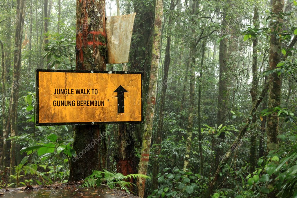
Hello fellow outdoorians! Today I want to talk about one of the most beloved hiking spots in Malaysia — Gunung Berembun, or as we like to joke, "jangan basah berembun pula bila sampai di puncak."
(For non-Malay speakers: embun means dew, so Gunung Berembun literally translates to Mountain Dew. Yes, like the drink. No, the summit does not taste citrusy.)
Jokes aside — you will absolutely get wet at the top, just with honest sweat instead of dew.
Gunung Berembun is one of those mountains that welcomes everyone, from total beginners to seasoned veterans looking for a chill weekend escape. It's completable within a day, the trails are well-defined, and the rainforest scenery is genuinely beautiful. If you've been putting off your first mountain hike, this is a solid one to start with.
Quick Stats: Gunung Berembun Cameron
- Difficulty: Easy
- Duration: 3–5 hours depending on trail and pace
- Distance: 2.7 km (shortest trail) to 3.6 km (longest trail)
- Summit Elevation: 1,840 metres (6,037 feet) above sea level
- Peak Coordinates: (4.472583, 101.400429) — View on Google Maps
- Number of Trails: 4
The 4 Trails of Gunung Berembun
The map below shows all 4 main trails and their starting points. The Shelter Junction (marked with a blue diamond icon) is the key convergence point you'll hear about a lot — it's where Trails 5 and 6 meet before continuing to the summit via Trail 3.
1. Trail No. 7 — Near MARDI Offices
Coordinates: (4.469300, 101.387136) — Trail 7 Start Point
This is the shortest trail to the summit and probably the best option for first-timers. It leads you straight to the peak without any detours. Fastest realistic summit time from here is around 3 hours. The trailhead is near the MARDI compound — just ask locals if you're unsure, Malaysians are generally happy to point you in the right direction.
2. Trail No. 5 — Near MARDI Offices
Coordinates: (4.470326, 101.386685) — Trail 5 Start Point
The trailhead sits just slightly north of Trail 7, also near the MARDI compound. This trail is a bit longer and takes you to the Shelter Junction (4.476798, 101.394694) first, where it connects with Trail 6. From Shelter Junction, you continue on Trail 3 to reach the summit.
3. Trail No. 6 — Sungai Pauh Campsite
Coordinates: (4.479825, 101.385076) — Trail 6 Start Point
This is the most popular trail, simply because it starts from Sungai Pauh Campsite — a proper campsite that can accommodate up to 300 campers. Entry fee is only RM3 per person and parking is RM5 per vehicle, paid at the campsite main office. Great value honestly.
Like Trail 5, this trail also leads to Shelter Junction (4.476798, 101.394694), after which you continue on Trail 3 to the peak. If you're planning to camp the night before your hike, starting from here just makes sense.
4. Trail No. 2 — Near Sam Poh Temple (Interconnects with Trail 3)
Coordinates: (4.489339, 101.391068) — Trail 2 Start Point
This is the longest trail of the four. A short way in, you'll hit a junction with Trail 3 (4.482370, 101.391819) — also known as the entry to the Smaller Mossy Forest. From there, follow Trail 3 straight to the summit. Note that hikers on Trail 3 can optionally detour right to visit Shelter Junction, but it's not required to reach the peak.
Campsite intel, weekend spot ideas, and family camping tips — straight from campers who just got back. Ask before you book.
💬 Join the Camping CommunityFree, one click. No spam — the occasional promo at most.
Requirements Before You Hike Gunung Berembun
1. Hiking Permit from Pahang State Forestry Department
You'll need to apply for a permit before heading up. Here are the relevant links:
- Main page: http://forestry.pahang.gov.my/index.php/en/perlesenan-permit/mendaki-gunung
- Online application portal: http://forestry.pahang.gov.my/ekorimba/main/index.php
Payment is via money order or bank draft. Sort this out before your trip — don't show up without it.
2. Proper Hiking Gear
Gunung Berembun is rated easy, but the rainforest terrain still demands decent gear. At minimum, you'll want to bring:
- Hiking poles — your knees will thank you on the descent. The TAHAN 3-Section Foldable Hiking Stick V2 (RM99) folds down compactly so it's easy to pack and carry when the trail flattens out.
- Knee support — if you've had any knee issues before or just want extra protection on rocky sections, the TAHAN Kinetix Knee Guard with Spring Support (RM79) is worth throwing in your bag.
- Hydration — a proper water bladder beats a water bottle on any trail. The TAHAN TrailBladder 2L (RM69) keeps you hands-free and well-hydrated throughout the climb.
- Hand sleeves for sun and branch protection
- Appropriate hiking footwear


If you're planning to spend the night at Sungai Pauh Campsite before or after your hike, you'll obviously need camping gear too — tent, sleeping bag, the works. For a fuller packing list, check out our Hiking Gear Guide for what to bring on Malaysian trails.
What Makes Gunung Berembun Worth the Trip?
Honestly, it's the rainforest. Malaysia's montane rainforest at this elevation is something else — mossy tree trunks, ferns everywhere, and a biodiversity that most people don't realise exists right in Cameron Highlands. The flora and fauna up here are genuinely special, and because Gunung Berembun isn't as overrun as some other trails, it still feels relatively unspoilt.
The other thing that makes it great is the flexibility. Four trails means different experiences depending on your fitness level or how much variety you want. Beginners can take Trail 7 and be done comfortably. More adventurous hikers can loop multiple trails and still find their way back without getting seriously lost — the trail network is well-connected.
At the end of the day, Gunung Berembun is one of those mountains that rewards you without punishing you too harshly. The difficulty is manageable, the views are worth it, and the sense of accomplishment when you hit the peak is very real.
If you've been to Gunung Berembun before or are planning a trip, drop a comment below — would love to hear your experience and any tips for fellow hikers reading this!
Also, have a read of our older post where we interviewed our ambassador on completing a gruelling 55 km CULTRA event trail — same area, very different challenge. Click here to read about Suyuen Wong and her prep tips.
And don't miss our Monthly Clearance deals — your wallet will appreciate it. Join the Malaysia Outdoor Community Facebook Group for more trail talk, gear advice, and trip reports from the TAHAN Outdoor community.
Campsite intel, weekend spot ideas, and family camping tips — straight from campers who just got back. Ask before you book.
💬 Join the Camping CommunityFree, one click. No spam — the occasional promo at most.














1 comment
Mike Chu
Hey there! For Berembun, the path is pretty clear but just make sure you apply your permits! :)
Hey there! For Berembun, the path is pretty clear but just make sure you apply your permits! :)