Bukit Perangin, Kedah: A Hiker's Guide (2026)
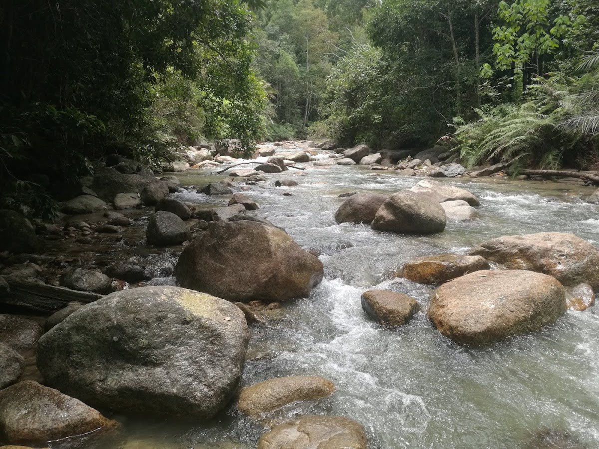
Bukit Perangin is Kedah's quiet little secret. Tucked away near Kampung Wang Perah, this hill forest reserve delivers exactly what most Malaysians want from a weekend hike — cool jungle air, the sound of rushing water, and a proper escape from the noise of everyday life. The main draw here isn't the summit (though the 180° views from the top via the Singkir Darat route are genuinely good). It's Perangin Falls and the extended Lata Perangin waterfall system, with seven documented levels of cascading water buried in dipterocarp forest.

This place suits families, beginners, and anyone who wants a relaxed day in the jungle without the crowds of more famous trails. That said, don't let the "easy" label fool you — stream crossings, slippery rocks, and leech country around the waterfall areas mean you still need to come prepared. The longer waterfall loop variants push into moderate territory with serious distance and elevation gain, so know which route you're signing up for before you lace up.
One thing repeat visitors keep mentioning: ini tempat cantik, tapi ada yang tinggal sampah. Please lah, pack out everything you pack in. A place this beautiful deserves better than that.
Quick Facts
- Peak Elevation: 711 m
- Main Loop Distance: 3.6 miles (5.8 km)
- Elevation Gain (Main Trail): 205 m (672 ft)
- Duration (Main Loop): 1.5–2 hours
- Waterfall Loop (Extended): 17.45 km, approx. 4.5 hours; elevation gain up to 500 m
- Difficulty: Easy to moderate (main loop); moderate on waterfall and summit variants
- Permit Required: Yes — RM 5.00 per person via Jabatan Hutan Kedah
- Guide Required: No
- Trailhead: Kampung Wang Perah, Kedah (GPS: 6.384157, 100.480)
- Parking: Available directly at trailhead
- Best Time to Go: Year-round
Getting There & Parking
The trailhead is at Kampung Wang Perah, Kedah, near the Kuala Nerang/Jitra area. You can drive directly to the trailhead — parking is available right there, so no long road walks before you even start. Plug the GPS coordinates (6.384157, 100.480) into Waze or Google Maps and it should get you close. If signal drops near the kampung, just ask the locals — they know the place.
There's no public transport serving this trailhead, so private vehicle or a carpool arrangement with friends is your realistic option. Coming from Alor Setar or Jitra, it's a manageable drive into the interior — give yourself a buffer for kampung roads in the last stretch.

Permits & Fees
A permit from Jabatan Hutan Kedah (Kedah Forestry Department) is required to hike Bukit Perangin. The fee is RM 5.00 per person. The process: apply online through the i-Forest portal at iforest.kedah.gov.my, receive your QR code, then present it at the district office counter to make payment. Don't just show up and hope for the best — sort this out before your trip.
Trail conditions and permit requirements change — always check with the local forestry office or park authority before you go. Or ask the TAHAN Hiking Community on WhatsApp — someone's usually been there that week. Checking a different gunung? Try our free permit checker — instant answer for 90+ Malaysian mountains.
The Trail: What to Expect
There are a few route options at Bukit Perangin, and they're genuinely different in terms of effort. The main 5.8 km loop is manageable for most people in a morning. The extended waterfall loop (17.45 km) is a full-day commitment. The Singkir Darat route to the 711 m summit is for those who want to earn the view — or set up camp overnight. Be clear on which one you're doing before you set off.
Stage 1: Trailhead at Kampung Wang Perah
The hike begins at the trailhead right where you park. The trail is well-marked on the main loop, so navigation isn't a major stress. Have your permit QR code ready and start early — getting in before 8am means cooler temperatures and the jungle mostly to yourself, which is one of the genuine pleasures of this place.

Stage 2: Hill Dipterocarp Forest
Most of the trail runs through classic hill dipterocarp forest — meranti, keruing, the full Malaysian jungle package. The dirt paths are generally defined but will get soft and slippery after rain. This isn't a groomed park trail — it's real hutan, and it asks for a bit of attention underfoot. The canopy is dense enough to give you shade, which you'll appreciate.
Stage 3: Stream Crossings
Multiple stream crossings throughout the route — this is where things get interesting and where some people get into trouble. The rocks in the stream carry algae growth and can be genuinely slick, especially after recent rain. Take your time, test your footing before committing your weight, and don't rush these sections. Wet feet are almost guaranteed on any visit, so plan your footwear accordingly. Leeches are common in and around these waterfall areas — check yourself regularly.

Stage 4: Perangin Falls
This is what most people come for. Perangin Falls is the main waterfall destination on the standard route — cold water, forest backdrop, and the kind of spot that earns all those five-star reviews. It's a proper reward after the walk in. If you're bringing kids or less experienced hikers, this is a natural turnaround point.

Stage 5 (Optional): Singkir Darat Route to Summit (711 m)
For those who want more, the Singkir Darat route takes you up to the 711 m peak with 180° views from the top. The elevation gain increases significantly on this variant (up to 500 m total). There is a camping spot at the summit for those who want to make it an overnight — rare for a hill this accessible. This is the route where the difficulty rating shifts firmly into moderate, with steep terrain demanding real effort on both the ascent and the knee-testing descent.
Stage 6 (Optional): Lata Perangin Multi-Level Waterfall Descent
The extended waterfall loop adds the Lata Perangin system, which has seven documented levels of waterfalls. At 17.45 km total with 4.5 hours of hiking, this is a different beast from the main loop. Only attempt this if your group is fit, experienced with stream navigation, and you've started early enough to finish well before dark. The terrain on the extended route involves all the same hazards — wet crossings, algae-covered rocks, leeches — but for much longer.

Descent & Safety
Coming down from the waterfall areas and especially the Singkir Darat summit route, the steep sections demand focus. Wet conditions make descents significantly more dangerous — muddy slopes and slick stream rocks cause the most falls. Take the stream crossings as seriously going down as going up.
Real hazards to know before you go:
- Leeches — common around waterfall areas. Wear leech socks or apply repellent. Check yourself at every rest stop.
- Slippery stream crossings — algae-covered rocks with no grip. Use a trekking pole or find a stable stepping stone before committing.
- Muddy and steep terrain after rain — this trail loses traction fast when wet. If it's been raining heavily, the longer routes in particular become genuinely risky.
- Getting benighted on longer routes — the 17.45 km waterfall loop is long. Start early, know your pace, and set a hard turnaround time if you're not summit camping.
If the weather turns bad mid-hike — heavy rain, thunder — get off the stream crossings immediately and find higher ground. A swollen stream in Malaysian jungle moves fast and dangerously. Don't gamble on crossing a rising stream. Turn back, wait it out, or hold position until conditions are safe.
What to Bring
For the main loop, packing is straightforward. For the longer waterfall or summit variants, each item on this list matters more.
- Water: Carry enough for your full route. The streams look clean but treat or filter any water before drinking. A TAHAN TrailBladder 2L Water Bladder keeps your hands free on the stream crossings and gives you easy access on the move — exactly what this kind of trail calls for.
- Footwear: Grip is critical. Trail shoes or boots with decent lug soles. Sandals at the waterfall, not on the trail.
- Trekking poles: Especially useful on the stream crossings and steep sections. The TAHAN 3-Section Foldable Hiking Stick V2 packs down when you don't need it and extends when you do — handy for a route that alternates between flat forest and technical crossings.
- Leech socks and repellent — non-negotiable near the waterfall areas.
- Change of clothes in a dry bag — you will get wet.
- Snacks and lunch — no stalls or warung on trail.
- Basic first aid kit — plasters, antiseptic, blister treatment.
- Headlamp — even for day hikes. If you're slow on the longer route, you don't want to cross streams in the dark.
- Permit QR code — printed or on your phone with a screenshot backup.
If you're new to Malaysian jungle hiking gear or planning to do more trails after this, check out our hiking gear guide — it covers what actually matters on local terrain.
FAQ
How hard is Bukit Perangin?
The main 5.8 km loop is easy to moderate — manageable for beginners and families with older kids who are comfortable on uneven ground. The challenge comes from the stream crossings and slippery rocks, not raw elevation. The Singkir Darat summit route and the 17.45 km waterfall loop push into moderate with real elevation gain (up to 500 m) and distance. Know which route you're doing and plan accordingly.
How long does Bukit Perangin take?
The main loop takes most hikers 1.5–2 hours. The extended 17.45 km waterfall loop takes around 4.5 hours. Add time for rest stops at the falls and stream crossings — they deserve it, and rushing them is where accidents happen.
Do I need a permit for Bukit Perangin?
Yes. Apply through the i-Forest portal at iforest.kedah.gov.my, collect your QR code, and pay RM 5.00 at the Kedah Forestry Department district office counter. Don't skip this — permits exist for a reason, and turning up without one wastes everyone's time.
Are there leeches at Bukit Perangin?
Yes, especially around the waterfall areas. This is standard for wet jungle trails in Malaysia — not a reason to skip the hike, but a reason to wear leech socks, tuck in your pants, and check yourself during rest stops. Come prepared and it's a manageable annoyance, not a disaster.
Camp Nearby?
Making a weekend of it? The Bukit Perangin area puts you in the northern interior of Peninsular Malaysia, with a few solid options within range. Sedim Signature Campsite is a strong pick if you want to stay close to jungle terrain — Sedim River Recreation Park is practically in the same neighbourhood, forest-wise. For something with a bit more comfort before an early start, Nadi Glamping Suites, Penang is a reasonable base if you're coming from the island or want a proper rest the night before. Down south toward Baling, KIF Campsite Baling is worth knowing about if you're stringing together a longer northern Kedah trip. And for those doing the Singkir Darat summit route — there's a camping spot right at the 711 m peak if you want to wake up above the treeline.
Trail conditions, permit updates, and hiking buddies for the weekend — all in one WhatsApp group. Just ask; someone was probably up there last week.
💬 Join the Hiking CommunityFree, one click. No spam — the occasional promo at most.
Mike has been camping across Malaysia for over 10 years — from jungle treks in Taman Negara to beach camps in Perhentian. He writes about it so you don't have to find out the hard way. Follow along on TAHAN Outdoor's blog for honest campsite reviews, every week.